


I spent a week linking La Fortuna, Río Celeste, Caño Negro and Sarapiquí by rental car across Costa Rica’s Northern Plains, driving only on the real roads most visitors face: Route 142 and 4 around Arenal, the lonely connector 138 into Caño Negro, the long agricultural stretches toward Puerto Viejo de Sarapiquí. What follows is not a fantasy itinerary but the route I actually drove, with the good and the frustrating: road surfaces, fuel stops, navigation hiccups, where the drive became tiring, and where one-night stops helped me avoid backtracking across this wide inland region.
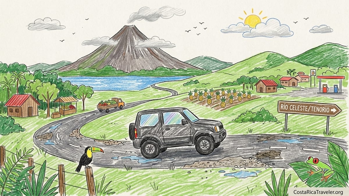
Picking Up The Rental Car And Leaving La Fortuna
I started and finished this loop in La Fortuna, which sits squarely in the Northern Plains region defined by Costa Rica’s tourism authorities as stretching from Arenal eastward through Caño Negro and down toward Sarapiquí. The morning of pickup I walked to a local office of a major agency on La Fortuna’s main drag and collected a small 4x4 SUV with automatic transmission and basic all-terrain tires. Agencies in this region strongly recommend at least a small SUV because many access roads are patched, potholed or partly unpaved, and the extra clearance really does make a difference when a surprise crater appears after a rainstorm. I took photos of every panel, the windshield and the existing scrapes on the plastic bumper, then checked that the spare tire, jack and reflective triangle were actually in the car.
Leaving La Fortuna is straightforward. Route 142 slices through town and heads around Lake Arenal, while Route 4 runs north through Muelle and eventually connects toward Los Chiles and Route 35. For this loop I mostly used Route 4 instead of circling the lake because it is faster and less tiring when you are planning to link Tenorio, Caño Negro and Sarapiquí in one trip. My navigation was a combination of Waze and offline Google Maps, both of which work well in this region as long as you download maps in advance. Mobile data dropped to a single bar several times between small villages, but the apps kept tracking my location and recalculated when I missed a turn.
On my first driving day I left La Fortuna under low gray clouds with the Arenal volcano hidden, a very typical scene in the Northern Plains where humid air lingers around the mountain. The paved road north of town is two lanes without shoulders, with local traffic that includes produce trucks, school buses and the occasional horse rider hugging the edge. Speed limits shift often between 40 and 80 kilometers per hour, and there are frequent school zones and speed bumps as you pass through tiny communities. It took roughly 20 minutes just to clear the outskirts of La Fortuna because of buses pulling in and out and pedestrians darting across in front of sodas and mini supermarkets.
Fuel is easy around La Fortuna. I topped up at a station on the edge of town before committing to Route 4 so I would not have to hunt for gas later in the day near Bijagua. Regular gasoline in late 2026 was selling for the equivalent of just under 2 US dollars per liter, with attendants pumping for you and taking either colones or a credit card. I kept the tank at least half full on this loop, which proved wise when stretches between larger towns felt surprisingly empty.
La Fortuna To Bijagua And Río Celeste: Potholes, Rain And Reward
The drive from La Fortuna to Bijagua, the small town that serves as a base for Río Celeste and Tenorio Volcano National Park, was my first taste of how different the Northern Plains can feel from Costa Rica’s coastal routes. From La Fortuna I followed Route 4 through agricultural land. The first section was relatively smooth asphalt with painted lines and light traffic, but as I pushed north the surface changed to patched segments with occasional deep potholes that forced me to brake hard or swerve slightly. That was when I was grateful for higher clearance and slower speeds. It had rained heavily the night before, and muddy splashes on the roadway made it harder to see where the worst holes were until I was almost on them.
Route 4 itself is not dramatic mountain driving, but the monotony can wear on you. Much of it runs straight across flat farmland, past pineapple fields and small villages with clusters of houses, pulperías and roadside fruit stands. Trucks carrying produce form slow-moving convoys and there are few official passing lanes, so patience is essential. I found that my actual average speed hovered closer to 60 kilometers per hour once I accounted for trucks, villages and construction areas where crews were filling potholes by hand. What looks like a two-hour trip on the map can easily stretch toward three when the weather turns wet and visibility drops.
The turnoff toward Bijagua is well signposted, and the road up into town improves dramatically in scenery. The pavement remains, but the route climbs toward the Tenorio foothills, with more curves, narrow bridges and occasional sections with no guardrails beside drainage ditches. On the day I drove it, low clouds rolled across the road and a light drizzle kept the windshield wipers on low the entire time. The small 4x4 felt stable on wet pavement, but I was glad I was not trying to cover this stretch in the dark. Locals often warn against night driving here because there is almost no street lighting, livestock occasionally wander near the edge and sharp bends appear suddenly out of darkness.
I chose a one-night stop in Bijagua to avoid backtracking from La Fortuna as a day trip. Official tourism materials sometimes describe Río Celeste as a popular excursion from Arenal, but that can mean more than six hours of round-trip driving in a single day when you add the park visit. By staying the night in Bijagua, I split the day into a gentle morning drive from La Fortuna, an afternoon walking around town and an early start to Tenorio the next day. Parking in Bijagua was simple. Guesthouses and small lodges offered secure gravel lots behind gates, and the main street had a modest number of marked spaces in front of sodas and bakeries.
Accessing Río Celeste And Returning To The Main Route
The access road from Bijagua to the Río Celeste sector of Tenorio Volcano National Park is short but worth describing. Leaving town after sunrise, I followed signs toward the park along a paved lane that soon gave way to segments of rougher surface and scattered potholes. The road is nominally two lanes, yet narrows to a single track in spots where erosion has eaten away at the outer edge. After a night of rain, small muddy rivulets ran across the pavement, and I saw several shallow puddles filling depressions that could hide deeper holes underneath. Again, the small SUV’s clearance let me roll slowly through without the horrible scraping noise you hear from low-slung sedans.
Parking at the park entrance felt organized compared with some other rural lots in the country. Staff directed cars into a terraced gravel lot with attendants wearing vests. I paid the parking fee in colones and left the vehicle in what felt like a secure area, with small restaurants and souvenir stalls looking onto the lot. This detail matters for drivers, because you will likely be away from the car for several hours while hiking to Río Celeste’s viewpoints and waterfalls. By starting early, I avoided the heaviest crowds of tour buses that arrive later from Guanacaste and La Fortuna.
After hiking in Tenorio and spending a second night in Bijagua, I rejoined the main road south of town to continue the loop. Instead of circling all the way back through La Fortuna or crossing the mountains toward the Pacific, I steered the car back to Route 4 with Caño Negro in mind. This is where the Northern Plains map becomes especially useful. If you look at the official tourist and cultural maps for this region, you see La Fortuna, Bijagua and Caño Negro aligned in a wide arc across the plains, connected by Routes 4, 35 and 138. It is not a tidy circle around a lake, but a broad sweep through wetlands and agricultural land that takes time. My navigation estimated roughly three and a half hours to reach the village of Caño Negro, not counting stops.
If I were planning the trip again, I would still keep Bijagua as a one-night waypoint between Arenal and Caño Negro. It reduces backtracking and breaks up what could otherwise be a punishingly long day of driving across the plains. However, I would skip trying to add extra side trips around Lake Arenal on the same day and keep the focus squarely on reaching the wetlands before late afternoon.
Bijagua To Caño Negro Via Route 4, 35 And 138
The route from Bijagua to Caño Negro is where the character of the drive changes from hilly forest edges to open cattle and rice country. I dropped back to Route 4, pointed the car toward Muelle de San Carlos and settled in for a long, straight run. At Muelle, a busy junction recognizable by a gas station and cluster of restaurants, I left Route 4 and joined Route 35 heading north toward Los Chiles. Official guidance for reaching Caño Negro from either La Fortuna or Bijagua often suggests driving nearly the full length of Route 35 before branching off onto Route 138, which serves as the main access road into the wildlife refuge area. That is precisely what I did, and it felt like the most straightforward choice.
Route 35, part of the corridor up to the Nicaraguan border, is paved along its length, but the definition of “good road” in the Northern Plains is relative. The surface alternated between smooth asphalt and heavily patched segments, with long linear cracks sealed in tar. Heavy trucks use this road, and at times I found myself tucked behind a line of vehicles crawling behind a sugarcane hauler. Passing lanes appear occasionally, but impatient drivers also pass on short straightaways, so defensive driving is important. The scenery outside the windshield turned to broad wetlands and flat pastures dotted with egrets and cattle, giving the first hint that Caño Negro’s marshes were not far away.
The turnoff to Route 138 is subtle. A modest sign indicates the junction before Los Chiles, and a smaller side road peels away toward the west. Route 138 is officially designated as the primary access road to Caño Negro Wildlife Refuge. On the day I drove it, the first kilometers were paved but rough, with jarring potholes that required weaving to avoid. Farther along, sections of compacted gravel and dirt replaced the pavement entirely. Recent local updates describe this road as partly paved and partly unpaved, and that matched what my tires found. In dry weather a standard sedan might manage, but in the rainy months a small 4x4 feels much more comfortable as rainwater collects in the low spots and mud softens the verges.
Traffic on Route 138 was sparse. For long stretches I saw no other vehicles, only birds lifting from roadside ponds and a few small farms set back behind barbed wire. Narrow one-lane bridges crossed dark, slow-moving water. Some bridges were concrete with low sidewalls, while others were simple metal spans with wooden planks that rattled as I rolled over them. There were no guardrails on several of these structures, and in heavy rain I can imagine visibility dropping to the point where you would want to slow to a crawl before each crossing. I was glad I had left Bijagua mid-morning and not late afternoon. The idea of driving this road after dark, with no lighting and foggy windows, did not appeal.
Staying In Caño Negro And Considering The Los Chiles Alternative
I reached the village of Caño Negro in the mid afternoon, roughly three and a half hours after departing Bijagua with a brief fuel and snack stop along Route 35. Caño Negro is small, with a scattering of hotels and lodges that cater mostly to wildlife watchers heading out on riverboat tours into the national wildlife refuge. The official protected area, recognized under the Ramsar Convention for its wetlands, lies just beyond the village along the Río Frío. I had prebooked a family-run lodge that offered fenced parking on a patch of grass behind the main building. The lot remained muddy from previous rains, but the ground was firm enough to support the SUV without sinking. Street parking in the village itself is informal, usually along dirt verges without painted lines.
Choosing Caño Negro as an overnight stop was deliberate. Some travelers base themselves in Los Chiles, a larger town on Route 35, and visit the refuge from there. However, that would have added even more backtracking for this loop. By staying directly in Caño Negro, I could walk to the small dock in the morning for a wildlife boat tour and then depart southward later in the day without having to rejoin Route 35 at Los Chiles and recross the same ground. In terms of route efficiency, Caño Negro sits as a sort of cul-de-sac reached by Route 138. You drive in, explore, and then return to the junction. Accepting that reality and making Caño Negro a true overnight rather than a rushed detour made the drive feel purposeful instead of like a marathon day trip.
The roads inside the village were mostly compacted dirt with puddles and ruts. Afternoon showers are common here, and a downpour during my stay turned several side streets into shallow brown pools. I avoided moving the car during the heaviest rain, partly to prevent splashing mud all over pedestrians and partly to keep from misjudging the depth of potholes hidden beneath standing water. When the rain eased, I walked the town instead of driving. For fuel, there was no station in the village itself that I felt confident relying on, so I had filled the tank along Route 35 earlier that day and kept a close eye on the gauge.
If I were repeating this loop, I would still include Caño Negro but I might skip driving farther north to Los Chiles. The birding and wildlife on the Río Frío from Caño Negro felt sufficient for a first visit, and the extra kilometers to Los Chiles would mostly have served to tick off a border town rather than add new scenery. The roads between Route 35 and Caño Negro are the real adventure here, not the final paved stretch up to the frontier.
Caño Negro Back To Route 4 And Onward To Sarapiquí
Leaving Caño Negro, there is no clever way to avoid retracing your steps. I drove back along Route 138 to Route 35, enduring the same mix of cracked pavement and gravel, though in morning light it felt less tense. From there I headed south again to Muelle, then rejoined Route 4 toward the Sarapiquí area. This section of the loop is where the distance between attractions in the Northern Plains becomes most obvious. On the official regional maps, Caño Negro, La Fortuna and Sarapiquí all appear in the same inland zone, but the straight-line impression hides the fact that you need many hours behind the wheel to connect them.
The run from the Route 138 junction down to Muelle on Route 35 took about two hours with light traffic. I stopped again at the large gas station at the Muelle crossroads to refuel and grab a simple plate of casado in the attached restaurant. This stop was not just about comfort; it was about ensuring I would not have to search for fuel later in the afternoon in more rural stretches between San Carlos and Puerto Viejo de Sarapiquí. Getting back on Route 4, I followed signs into the Sarapiquí canton, an area that official conservation and tourism guides describe as a mosaic of protected forests, rivers and agricultural land straddling the boundary between the Northern Plains and the Caribbean lowlands.
The road toward Sarapiquí is fully paved but far from perfect. I crossed several narrow bridges with single lanes controlled informally by local courtesy rather than signals. You slow, check for oncoming vehicles, and wave someone through if you both arrive at once. After rain, slick patches appear where runoff carries debris across the road surface, and fallen branches can linger at the edge of the lane. Traffic included more tour minibuses here, heading for popular private reserves and lodges near Puerto Viejo de Sarapiquí and La Virgen. Drive times on this stretch can stretch out beyond what the map suggests as trucks slow on hills and buses make frequent stops to pick up workers heading to banana and pineapple plantations.
By the time I approached Puerto Viejo de Sarapiquí, the afternoon sun cut through patchy clouds and humidity wrapped the car like a blanket. This was the most tiring part of the day’s driving. After several hours of concentration across the plains, small distractions started to pull at my attention: kids on bikes wobbling along the shoulder, dogs sleeping near the white line, a truck ahead of me signaling an ambiguous turn into a side road. I was relieved to pull into the gravel driveway of a riverside lodge with secure parking. The lodge’s lot was shaded, and staff directed me to a space under trees away from where large buses turned around. It reinforced a rule I now apply across Costa Rica: build in fewer, longer stays when connecting spread-out inland destinations, and avoid planning more than four to five hours of driving in a single day.
Base In Sarapiquí And What I Would Skip Next Time
I used Sarapiquí as my final inland base before turning back toward the Central Valley. Puerto Viejo and nearby communities like La Virgen sit firmly within the Northern Plains tourism region, recognized for their river-based activities and rainforest reserves. From my lodge I could reach private reserves and rafting put-ins within 15 to 30 minutes, usually along narrow paved roads flanked by plantations. These local drives were short but still demanded attention. Many side roads to lodges and reserves turn to gravel just before the entrance, often with steep concrete ramps at the final turn. In heavy rain, these ramps become slick, but the small 4x4 climbed them without spinning the wheels.
Parking in the Sarapiquí area was generally easier than around Arenal. Lodges and activity providers had on-site gravel or grass lots, occasionally with simple security measures such as a gate or overnight guard. For a guided river float, I left the car in a roadside lot where the outfitter’s staff watched vehicles while groups were on the water. I took valuables with me and left nothing visible on the seats, a basic precaution that makes sense anywhere. One afternoon thunderstorm delivered a burst of rain so intense that the lot temporarily flooded ankle-deep near the entrance, but the cars themselves remained on slightly raised gravel mounds.
Reflecting on the loop as a whole, there are sections I would handle differently in a future trip. I would not attempt to chain La Fortuna, Bijagua, a full Río Celeste hike and a late arrival in Caño Negro in a single day. On paper, the distances seem manageable, but the combination of slow trucks, patchy pavement and sudden downpours makes such compression stressful and potentially unsafe. Splitting Arenal to Bijagua and then Bijagua to Caño Negro into separate days, as I did, felt right and kept fatigue manageable. What I might skip is adding extra detours back toward Lake Arenal viewpoints between these legs. Once you commit to crossing the plains, it makes more sense to keep moving steadily toward the wetlands.
I would also consider whether it is worth using Sarapiquí as a through-stop in a single-night sense, rather than a two- or three-night base. If your main interests are Arenal’s hot springs, Río Celeste’s waterfall and Caño Negro’s wildlife, Sarapiquí might feel like one inland forest stop too many. On this trip, I was glad to experience the rivers and lodges, but for a shorter vacation I would probably either begin or end the loop there, pairing it with the Central Valley instead of trying to wedge it between La Fortuna and Caño Negro. That would reduce overall backtracking and cut at least one long day on Route 4 from the itinerary.
The Takeaway
Driving the Northern Plains loop that links La Fortuna, Río Celeste, Caño Negro and Sarapiquí is very doable in a rental car, but the map does not tell the whole story. Official tourism material rightly groups these destinations into one inland region, yet in practice they are scattered across a wide landscape of farms, wetlands and rivers connected by just a few key asphalt and gravel routes. The reality on the ground includes narrow bridges without railings, patched roads with unpredictable potholes, long stretches without services and tropical downpours that can slash visibility in seconds. These are not reasons to avoid driving here, but they are reasons to plan conservatively and take your time.
Starting with a small 4x4 from a reputable agency in La Fortuna set the tone for the trip. Keeping the fuel tank at least half full, building in one-night stops in Bijagua and Caño Negro to avoid punishing backtracking days, and using Sarapiquí as a relaxing final base rather than a rushed waypoint kept fatigue at bay. Navigation apps worked well, but offline maps and a basic understanding of key junctions, especially around Muelle and the Route 138 turnoff, proved just as valuable. When the roads turned rough, lowering my speed, giving trucks plenty of room and avoiding night driving made the loop feel like an engaging journey instead of a white-knuckle ordeal.
If your image of Costa Rica is only coastal highways, this Northern Plains circuit will surprise you. It offers moments of big-sky wetlands, quiet cattle pastures, volcano views and lowland rainforest filled with bird calls, all tied together by the simple act of driving across a part of the country that most visitors only glimpse on maps. Armed with realistic drive times, an understanding of the roads you will actually face, and a willingness to slow down when rain sweeps in over the plains, you can stitch Arenal, Río Celeste, Caño Negro and Sarapiquí into a single, satisfying overland story.
FAQ
Q1. Do I really need a 4x4 to drive this Northern Plains loop?
For much of the loop a regular car can pass, but a small 4x4 or higher-clearance SUV makes Route 138 to Caño Negro and the access road to Río Celeste more comfortable, especially in rainy months.
Q2. How long does it take to drive from La Fortuna to Bijagua?
In normal conditions, following Route 4 and the signed turnoff toward Bijagua, expect around two and a half to three hours of driving once you factor in trucks, villages and occasional roadworks.
Q3. Is the road into Caño Negro paved the whole way?
No. Route 138 between Route 35 and Caño Negro is a mix of worn pavement and gravel or dirt segments, with potholes and some one-lane bridges, so speeds are slow.
Q4. Are gas stations easy to find along this route?
Fuel is easy around La Fortuna, Muelle and larger towns along Route 35, but options are limited closer to Caño Negro, so it is wise to top up before leaving the main highways.
Q5. Is night driving safe in this region?
Night driving is physically possible but not recommended, as many roads lack lighting, livestock and pedestrians can appear suddenly and rain or fog often reduce visibility.
Q6. How did you handle parking at Río Celeste and in Caño Negro?
At Río Celeste, I used the official gravel parking lot at the park entrance, and in Caño Negro I chose lodging with a fenced on-site lot on grass or gravel.
Q7. Can this loop be driven in a standard automatic transmission car?
Yes, I completed it in an automatic SUV and never needed low-range gearing, but the extra clearance and traction were reassuring on rough or flooded patches.
Q8. How many days should I allow for this La Fortuna–Bijagua–Caño Negro–Sarapiquí route?
A comfortable version would allow at least five to six nights, with one night in Bijagua, one in Caño Negro and two or more in both La Fortuna and Sarapiquí.
Q9. What was the most tiring driving segment of the trip?
The long day returning from Caño Negro via Route 138 and 35, then continuing on Route 4 toward Sarapiquí, felt most tiring because of distance, truck traffic and afternoon heat.
Q10. Would you include Sarapiquí again on a shorter Northern Plains itinerary?
For a shorter trip focused on Arenal, Río Celeste and Caño Negro, I might skip Sarapiquí or save it for another visit, as including it adds another long driving leg across the plains.