


On paper, Costa Rica’s Pacific side looks simple. Official guidance describes a dry season from about December through March, a transitional April, a rainy or green season from May through October, and a softer November, with a brief mid‑rainy‑season lull in July and August that locals call the veranillo. In reality, those broad bands play out very differently as you drive down the coast from Guanacaste to the Central Pacific and on toward the southern rainforests. After multiple trips in both dry and green seasons, I have learned that choosing “the best time” to visit the Pacific coast is less about the calendar and more about where you are along it.
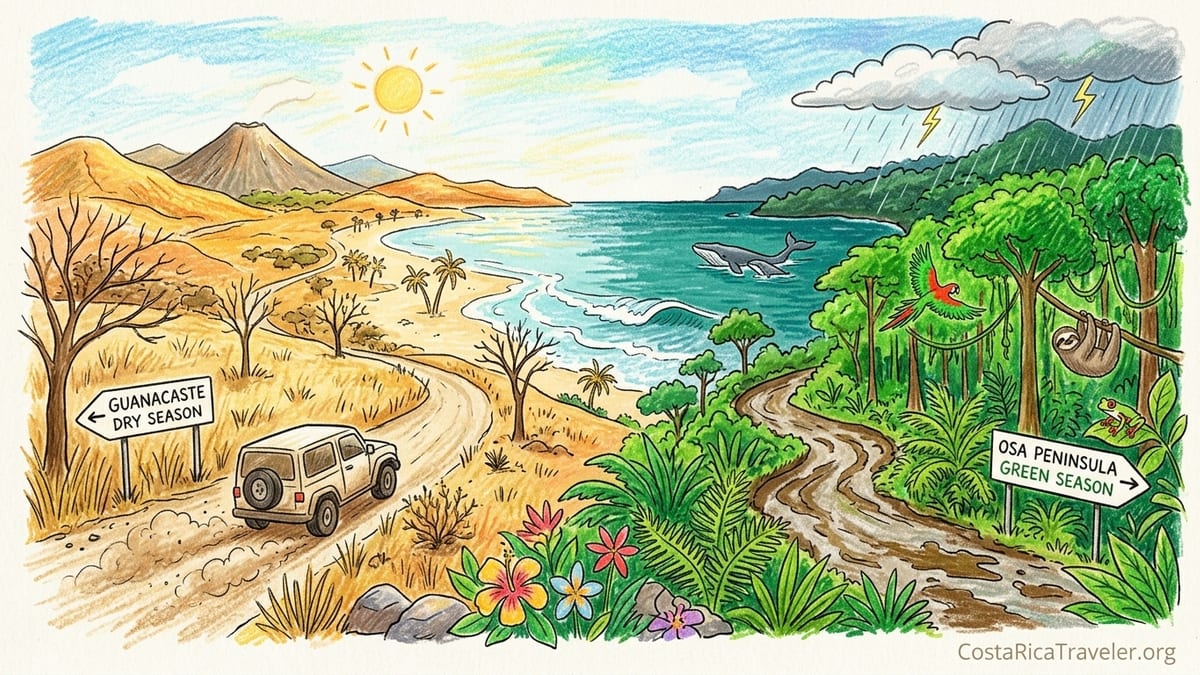
How Costa Rica’s Pacific Seasons Really Work
Official climate descriptions for Costa Rica are consistent. The Pacific slope has a well defined dry period that runs roughly December through March, with April as a transitional month, and a rainy period from May through October, followed by another transitional month in November. There is usually a relative dip in rainfall during July and August known as the veranillo, or little summer, which is noticeable on much of the Pacific side. Rainfall generally increases the farther southeast you travel along the coast, so Guanacaste in the northwest is the driest Pacific region, while the southern Pacific around the Osa Peninsula is the wettest.
Those broad patterns are accurate, but they hide crucial local differences. In Guanacaste, around Liberia and Tamarindo, “dry season” has meant weeks for me without a single drop of rain, parched hillsides the color of straw, and dust hanging over the roads. In contrast, the same February weeks around Uvita and the Osa Peninsula have still felt humid and green, with occasional passing showers and towering clouds building over the rainforest every afternoon, even in what is technically the dry season. The shape of the year is the same, but the feel on the ground is not.
Understanding these nuances matters because they affect almost every aspect of a trip. The timing and intensity of rainfall shapes road conditions, surf, river levels, and water visibility. Humidity determines how comfortable you will feel on the beach at midday, how easy it is to sleep without strong air conditioning, and even how often you will want to hike. Differences in seasonality also influence when hotels in specific regions offer lower off‑season prices or raise them for high demand weeks, and when popular beach towns feel crowded or pleasantly quiet.
The following sections draw on several visits I have made in both dry and green seasons in Guanacaste, the Central Pacific, and the southern Pacific, along with clearly marked research where I have not personally traveled in a given month. The goal is not to declare one “perfect” month, but to help you match each stretch of coast to the conditions you care about most.
Guanacaste Dry Season: Dust, Surf and Bright Blue Skies
Most visitors get their first taste of Costa Rica’s Pacific dry season in Guanacaste, thanks to the international airport at Liberia and easy access to beach towns such as Tamarindo, Playa Flamingo, Playa Hermosa and Nosara. Official climate profiles describe Guanacaste as the region with Costa Rica’s most pronounced dry season, sometimes stretching close to six months on the plains around Liberia. On my January and February visits, that description has felt entirely accurate. By New Year, rain had already disappeared for several weeks, and by late February I was walking through landscapes that looked more like African savanna than postcard jungle.
Rainfall timing here is stark. In mid January in Tamarindo, I did not see a single shower across a ten day stay. Locals told me that once the last November or early December storms pass, clouds often vanish and may not return in any serious way until May. That stability creates the classic blue sky mornings that many beach travelers seek. It also means humidity drops compared with green season, which makes afternoons a little more tolerable even as temperatures climb well above 30 degrees Celsius. The tradeoff is that by late dry season, hillsides fade to brown, and even forest reserves around places like Rincon de la Vieja look noticeably drier and dustier.
Road conditions and dust are defining features of Guanacaste’s dry season. Driving the partially paved and dirt routes from Liberia to beaches like Avellanas or some stretches around Nosara in February, my rental car kicked up chalky clouds that lingered along fences and tree branches. Roadside plants were coated in beige powder, and by the time I reached my lodging my bags carried a fine layer of dust. The upside is that rivers and seasonal streams are low or even dry, so the rougher road segments become more passable, and you rarely need to worry about landslides or washouts on coastal routes. I have comfortably reached more remote beaches in a simple two wheel drive compact car in February that would have been much riskier in October.
For surf and swimming, the Guanacaste dry season has been generous on my trips. In Tamarindo and Playa Grande, mornings in February have usually brought clean, shoulder high sets for intermediate surfers, with offshore winds grooming the waves. Water visibility has been mixed. In the heart of dry season, sediment from rivers is low, and in calmer bays like Playa Conchal I have snorkeled among schools of small reef fish in water that felt reasonably clear. At more open surf beaches, constant wave action keeps the water somewhat stirred up, so visibility depends on recent swell activity. Overall, though, I have noticed clearer water for casual swimming and stand up paddling in February than on my May and June visits.
Crowds and prices reflect how attractive these conditions are. In late December and the first week of January, and again around Easter, beachfront hotels and condos in Tamarindo often price standard rooms at several times their low season rates, and it is genuinely difficult to book high demand properties at short notice. Staff at one mid range hotel told me that their January occupancy is usually above 90 percent, while in October they may run closer to half that. In late February and early March, the atmosphere eases slightly, but restaurants can still feel full by sunset and beginner surf schools line up students along the main breaks. If you want reliably dry weather in Guanacaste without peak holiday crowds, I have found late January and early February to be a workable compromise, provided you book lodging and rental cars well in advance.
Central Pacific Seasons: Transitional Weather and Afternoon Storms
South of the Nicoya Peninsula, the Central Pacific coast around Jacó, Herradura and Manuel Antonio follows the same broad seasonal pattern, but conditions feel more transitional. I have visited this stretch in late March at the tail end of the dry season, and again in July and early August during the veranillo. Each time, the mix of sunshine, humidity and afternoon storms has been very different from the near absolute dryness of Guanacaste in the same months.
In late March around Jacó and Herradura, the forested hills above town were already browning, but not to the same extent as near Liberia. Mornings were usually bright and clear, which matched the official dry season label, yet humidity felt higher. By mid afternoon, substantial clouds often bubbled up over the mountains, and on several days a short, sharp shower swept through after 3 p.m. These bursts were not enough to renew the landscape fully, but they did tamp down dust on the main road into town and cooled temperatures slightly for evening walks on the beach. Compared with Guanacaste, I needed air conditioning more consistently at night in March here, simply because the air felt heavier.
Roads and access in the Central Pacific dry season are straightforward. The highway from San José down to Jacó and Quepos is paved, and major side roads to beaches like Playa Hermosa de Jacó or the entrance to Manuel Antonio National Park stay in good shape in March and April. In my own driving I have not encountered washed out sections or deep potholes at that time of year. Closer to May and June, local guides have told me that the first serious storms can trigger small landslides in the hills, temporarily affecting minor roads, but the core tourist infrastructure remains accessible. Compared with the southern Pacific, where heavy green season storms can significantly affect dirt tracks, the Central Pacific has felt easier and more forgiving to navigate.
The mid‑rainy‑season veranillo has produced some of my favorite Central Pacific conditions. On a July trip based in Manuel Antonio, mornings were often fully sunny, with slanting light on the white sand of Playa Espadilla and capuchin monkeys active in the park. Clouds built steadily after lunch, and on perhaps half the days a thunderstorm rolled in between 2 p.m. and 4 p.m., drenching the forest and briefly turning local streams a deeper brown. By early evening, skies frequently cleared again for sunset. Rainfall was far from constant. I still managed long morning hikes, ocean swims and even an early afternoon catamaran cruise without feeling that weather had dominated the day.
These patterns matter for wildlife and water visibility. During my July visit, the surrounding forest in Manuel Antonio was a saturated green, and I saw more bird activity and more visible sloths and monkeys along the park trails than on my March trip, when mid day heat seemed to push many animals deeper into the canopy. Ocean water in July had a slightly reduced visibility near river mouths after heavy rain, but snorkeling off small offshore islets still delivered clear enough views of reef fish. For casual swimming, I found the tradeoff acceptable. Hotel pricing in July was markedly below Easter and Christmas levels, with several mid range properties in Quepos and Manuel Antonio quoting rates that were roughly a third lower than their peak season racks, even though they were far from empty. For me, that combination of lush forest, manageable afternoon storms, and softer prices makes the Central Pacific appealing in both late dry season and around the veranillo, depending on your tolerance for humidity.
Southern Pacific and Osa: True Rainforest in Both Seasons
The further south you go along Costa Rica’s Pacific coast, the more pronounced the rain becomes, especially around Dominical, Uvita and the Osa Peninsula. Climate data and local tourism boards describe the southern Pacific as one of the country’s wettest regions, with the same dry and rainy framework as the rest of the Pacific, but with higher totals in the green season and noticeably greener surroundings even in the dry months. My trips here in February and again in early September have shown how different the same calendar labels can feel in this part of the country.
In February based near Uvita, I woke up to blue skies and calm seas most mornings, consistent with the official dry season window. Yet the hills were still cloaked in dense, dark green rainforest, and the air felt consistently humid, especially compared with Liberia or Tamarindo. Short showers popped up a few times in the late afternoon during a ten day stay, never long enough to disrupt plans, but often enough to release the rich, earthy scent of wet jungle soil. Trails in Marino Ballena National Park and private reserves had dry sections but also muddy patches under deeper shade, and sandals were a poor choice for serious walks. Compared with Guanacaste, where January and February ground had been dry and almost crunchy underfoot, the same months here still felt very much like a rainforest.
Road conditions in the southern Pacific are especially sensitive to rain. The main coastal highway is paved and was in good condition on my February visit, but reaching more remote trailheads and lodges often required driving on steep dirt tracks. In the dry months, these roads were rutted but passable in a high clearance two wheel drive vehicle. Local hosts told me plainly that in heavy green season months such as September and October, those same routes can become deeply muddy, and river crossings that were narrow trickles in February can swell rapidly after an afternoon storm. On my early September trip to the Osa Peninsula, I saw this in practice. What had been an easy shallow crossing near Puerto Jiménez in February turned into a wide, fast flowing ford that our 4x4 approached with real caution after several days of sustained rain.
The nature of rainfall here in the heart of the green season deserves attention. In my experience in early September, mornings were often overcast but mostly dry, with occasional sun breaking through. Around lunchtime, the first showers would begin, and by mid afternoon storms could be heavy, with rain pounding on the metal roof of my cabin for an hour or more. Some days the pattern reversed, with a dramatic overnight deluge fed by moisture from the Pacific and lower key drizzle in the afternoon. There were still fully dry days, but they felt like exceptions. Humidity, both inside and outside, remained high. Clothes took longer to dry, and trail conditions ranged from slippery roots to full standing water on certain jungle paths in Corcovado National Park.
Yet those same conditions amplified the region’s strengths. River levels in September supported excellent waterfall visits near Uvita and powerful rafting on rivers fed by southern watersheds, although exact operations vary by company and rainfall. The forest came alive with frogs, bird calls and the rustle of coatis along the leaf litter. Water visibility in the Golfo Dulce after heavy rain was lower near river mouths, with a tannin tinted brown layer, but out toward open water I have still encountered surprisingly clear patches when snorkeling on dry mornings, with rays and sea turtles visible below. Whale watching in the southern Pacific is one of the major reasons travelers deliberately choose the heart of green season. Humpback whales from the Southern Hemisphere typically migrate through these waters roughly from July into October, with operators in Uvita and Drake Bay running daily tours when sea conditions permit. On my September trip, a morning outing rewarded us with several breaches from a mother and calf pair, though departures later in the week were canceled when storms built too quickly offshore.
Green Season Contrasts: From Guanacaste Showers to Southern Downpours
Experiencing the Pacific coast in green season from north to south has highlighted how rainfall can be both manageable and transformative. In Guanacaste, my May and June stays around Nosara and Tamarindo felt like a gentle reset after the dryness of April. The first weeks of May brought often sunny mornings, with rain mainly in the late afternoon and early evening. Hills that had been brown in March began to flush green again by late May. Roads that had been dusty became firmer and slightly muddier, but I did not encounter impassable sections on the main tourist routes at that early stage of the rainy period.
By contrast, when I returned to Guanacaste in late August, during what is statistically part of the veranillo, conditions were more variable. I experienced several consecutive days where rain held off until after 4 p.m., allowing long beach days and consistent surf sessions. Swell from distant storms in the South Pacific produced more powerful waves than I had seen in February, appealing to advanced surfers but challenging for beginners at exposed breaks like Playa Grande. On a different August week two years later, short showers began before midday on multiple days, a reminder that the veranillo is a relative reduction in rainfall rather than a guarantee of dryness.
On the southern Pacific in early September, there was no mistaking that I was in true rainy season. Rivers were high and often chocolate brown. Trails in the Osa’s primary forest demanded proper waterproof boots or sandals that could handle deep mud. Afternoon storms were heavy enough that several lodges adjusted activity schedules, prioritizing early morning birding and then indoor or sheltered activities later in the day. One lodge near Carate closed entirely in October because persistent heavy rain made its access road unreliable. Local operators confirmed that while tourism continues through much of the green season, September and October on the far southern Pacific coast are often when occupancy and prices are at their lowest, precisely because of these challenging conditions.
These contrasts extend to swimming and water clarity. Along the Nicoya and northern beaches in June, I still found the ocean inviting for long swims, though water felt a touch cooler and murkier near the mouths of seasonal rivers. Visibility for snorkeling was reduced after heavier squalls but recovered relatively quickly after a couple of dry days. In the south near Uvita in September, silt and organic material from swollen rivers often colored the nearshore water, particularly after overnight storms. For clearer visibility, local guides recommended offshore reefs and islets on days following lighter rain, or accepting that wildlife experiences would skew more toward rainforest and whales than reef fish during the wettest months.
Hotel prices and crowds shift accordingly. In Guanacaste in June and early July, properties that had sold out months in advance in January were openly advertising promotions, with mid range rooms that might cost several hundred US dollars per night in late December offered at noticeably lower rates. In Uvita and Drake Bay in September, several small lodges quoted rates along the lines of “green season specials,” sometimes bundled with activities. At the same time, owners acknowledged that they might close for parts of October if storms became too intense. For travelers willing to accept real weather risks, this part of the calendar can deliver exceptional value, but flexibility is important.
How Seasons Shape Experiences: Swimming, Surf, Wildlife and Value
Across these regions, the practical implications of season stretch far beyond whether or not you will need a rain jacket. If your priority is relaxed swimming and beach time with minimal weather disruption, I have found that the December to March dry season in Guanacaste and the Central Pacific offers the most reliable conditions. The seas are generally calmer, water is warm and inviting, and daily sunshine is dependable. Central Pacific beaches like Manuel Antonio and Playa Blanca combine this with still green surroundings in December and January, before late season dryness peaks. My own January mornings in Manuel Antonio felt ideal for families and casual swimmers, with light waves and lifeguards on the busier stretches.
For surfing, the answer is more nuanced. Consistent, clean conditions for intermediate surfers are common on the northern Pacific during the dry season, especially in January and February, when offshore winds are reliable. However, some of the most powerful swells I have ridden have arrived in the heart of the green season, particularly from May through August, when Southern Hemisphere storms send long period waves up the Pacific. Advanced surfers often time trips around these pulses, accepting the risk of rain in exchange for larger, more challenging surf at beaches like Playa Hermosa near Jacó, Santa Teresa, or the reef breaks near Pavones in the far south. The veranillo can be a particularly attractive compromise for surfers, with relatively stable mornings and increased swell.
Wildlife viewing and forest color also change dramatically with the seasons, especially as you head south. In Guanacaste during peak dry months, hills and pastures can be so parched that locals joke about “brown season.” On a March visit to the Central Pacific, I remember looking toward an offshore island near Playa Blanca and initially thinking it had recently burned, only to be told that I was simply seeing the cumulative effect of months of sun and wind on sparse coastal vegetation. Southern rainforests tell a different story. In Uvita and the Osa, the forest in February was still green and vibrant, and by September it felt almost hyper saturated. Bird and amphibian activity seemed higher on my early morning walks during the green season, with tree frogs calling from puddles beside the trail and toucans more frequently sighted along fruiting trees.
Whale watching is one of the clearest examples of how southern Pacific seasonality shapes experiences. Although some humpback whales can be seen off the Pacific coast during the broader dry season, many operators emphasize the July to October window, when Southern Hemisphere populations move through the region. My September trip to Uvita coincided with this migration. Guides there described late August and September as among their favorite months to take guests out, provided sea conditions allow departures. This means that a traveler who insists on visiting only in January for maximum sun will almost certainly miss the peak of this spectacle in the south.
From a value and crowd perspective, the tradeoffs are straightforward but powerful. Dry season weeks from late December through March, plus Easter, command the highest prices along the Pacific coast, with Guanacaste at the top. Rental cars book out, popular national parks limit daily entries, and restaurant reservations start to matter in the most visited towns. By contrast, May, June, and much of November often deliver a more balanced mix of reasonable weather and lower prices. On my June trip to Nosara, I booked comfortable mid range lodging within walking distance of the beach for significantly less than the same property quoted me for January. Afternoon rain did shorten a few surf sessions, yet the quieter atmosphere and lush surroundings made the compromise feel worthwhile.
The Takeaway
After repeatedly traveling Costa Rica’s Pacific coast from north to south in both dry and green seasons, I have given up looking for a single best month. What has become clear is that the phrase “Pacific dry season” glosses over huge regional differences. In Guanacaste, it can mean months without meaningful rain, dusty roads and fully brown hillsides, with still, hot evenings that demand strong air conditioning. On the southern Pacific at the same time, it can mean mostly sunny mornings but with humid air, deep green forest, and occasional short showers that remind you that you are, fundamentally, in a rainforest.
If I were choosing purely for relaxed swimming and easy logistics, I would lean toward late January or early February on the Central or northern Pacific. Roads are dry, rivers are low, and the chance of a full day lost to rain is very small, while some of the absolute peak holiday pricing has eased. For surfing, my personal preference is to visit in late May or July on the Pacific, when swell energy is stronger and the veranillo often brings more stable mornings, even though I accept frequent afternoon storms and slightly murkier water.
For wildlife and rainforest immersion, including birdlife and frogs, I would choose the southern Pacific in the heart of the green season, from roughly August into early October, provided I was ready for intense humidity, real mud and a flexible schedule that can absorb weather related cancellations. That is also when I would target humpback whale watching out of Uvita or Drake Bay. For value and fewer crowds across most of the Pacific, I have had excellent experiences in June and in the second half of November, when prices are usually lower, forests are green, and yet road conditions and river levels are more manageable than in the absolute peak of heavy rain.
Ultimately, the “best” time to visit Costa Rica’s Pacific coast is the time when the realities of each region’s season match your priorities. Dry season is not a single uniform experience that feels the same from Tamarindo to the Osa. Green season is not one endless deluge. Once you think in terms of where on the Pacific you plan to go, and what you most want to do there, the calendar becomes less of a rulebook and more of a menu.
FAQ
Q1. Is December really dry everywhere along Costa Rica’s Pacific coast?
In my experience, December is usually dry in Guanacaste and the Central Pacific, but the southern Pacific can still see some showers, especially early in the month, even though the trend is toward sunnier days.
Q2. How intense are afternoon storms in the green season?
They vary by region and month. Around Jacó and Manuel Antonio in June and July, I have often seen one to two hour downpours in late afternoon, while on the Osa Peninsula in September, storms have sometimes been heavier and longer, occasionally affecting road conditions.
Q3. Can I drive a regular rental car during rainy season in Guanacaste?
On main paved routes to popular beaches, I have managed with a regular two wheel drive car in May and June, but unpaved side roads can become slippery, and for more remote beaches or after heavy rain, a high clearance vehicle or 4x4 provides a useful margin of safety.
Q4. When is water clarity best for snorkeling on the Pacific side?
In my trips, the clearest nearshore water has usually been in the heart of the dry season, from January through March, particularly in protected bays of Guanacaste and on calm mornings in the Central Pacific, before rivers begin carrying more sediment in the rainy months.
Q5. Does the veranillo really make July and August feel like a mini dry season?
On the Central and northern Pacific, I have often enjoyed several consecutive mostly sunny days in July with rain limited to late afternoons, but it has never felt as dry or as predictable as January, and some years showers have started earlier in the day.
Q6. Are hotel prices always lower in the green season?
Prices I have seen in May, June and much of November have generally been lower than in January or during Easter, but not uniformly. Certain boutique properties and prime surf lodges sometimes stay busy year round, so checking specific dates and locations still matters.
Q7. Is it safe to swim in the ocean during the rainy season?
I have swum throughout the green season on the Pacific, but I pay close attention to local lifeguards, surf flags and currents, because stronger swells and river outflows can change conditions quickly, especially near river mouths and rocky points.
Q8. When would you personally choose the southern Pacific over Guanacaste?
I would choose the southern Pacific from about August to early October if I wanted dense green rainforest, higher wildlife activity and a chance to see humpback whales, and I would pick Guanacaste in January or February for simple beach days and more reliable sun.
Q9. How do river levels affect travel plans?
In dry months, rivers in Guanacaste and parts of the Central Pacific have been low or even dry on my trips, making crossings straightforward, but in September on the Osa Peninsula I have seen rivers rise enough after storms that guides postponed excursions or chose alternate routes.
Q10. Is there a single best month for fewer crowds and decent weather?
Based on my travels, there is no universal best month. If I had to choose a compromise, I would look at June or late November on much of the Pacific coast, with the understanding that conditions still vary between drier Guanacaste and wetter southern rainforest regions.