

Driving Costa Rica’s Pacific coast was the most beautiful and most tiring road trip I have done in Central America. I went in expecting a single dreamy coastal highway from the beaches of Guanacaste down toward the Central and South Pacific. What I found instead was a patchwork of inland detours, busy truck corridors, resort access roads and only occasional stretches where the sea and the asphalt kept each other company. This is the story of that north to south drive, told from the actual roads I used, with the things I got wrong that you can still get right.
Picking Up the Car and Reaching the Pacific
I started the trip by collecting a rental car at Liberia’s Daniel Oduber Quirós International Airport, the main northern gateway for Guanacaste’s beach resorts. The agencies at Liberia cluster just outside the terminal, with shuttles running to off-site lots. I chose a compact sedan with automatic transmission and air conditioning, a 2WD vehicle instead of a 4WD SUV, after checking that my planned route would stay on paved national highways and established resort access roads rather than the rougher backroads of the Nicoya Peninsula or the Osa region.
The rental counter process took longer than I expected. Costa Rican law requires basic third-party liability insurance, and the deposit on the credit card was higher than most first-time visitors anticipate. I opted for the mid-level collision coverage with a deductible, declined extras like a portable Wi-Fi hotspot, and confirmed the fuel policy as “full to full,” meaning I left with a full tank and had to return it the same way. I also made sure the contract allowed me to drive across provinces, since I would be heading from Guanacaste into Puntarenas province further south.
The Pacific portion of my trip technically began when I left Liberia and headed toward the coast around Playa Hermosa and Playas del Coco in northern Guanacaste. From the airport exit, the drive to these beaches uses well-paved secondary roads lined with gas stations, supermarkets and hardware stores. It felt straightforward and forgiving, with clear signage to the better-known beaches. That first day lulled me into believing the rest of the Pacific side would be just as easy.
In reality, what followed proved that there is no single uninterrupted oceanfront road in Costa Rica. From Liberia and the northern beaches, you repeatedly duck inland to rejoin the main north-south corridor, then branch back out to individual coves and resort areas. The ocean is often only visible at the end of the detours, not from the road itself.
Guanacaste: Inland Highways, Beach Detours and Unnecessary 4WD
My first significant north to south segment ran from the Liberia and Papagayo area down toward the Tamarindo and Flamingo region. Rather than tracking any imaginary coastal byway, this leg followed inland paved roads through cattle country, with the Pacific mostly out of sight. The main artery here is Route 21, which carries steady local and vacation traffic between Liberia, Filadelfia and the crossroads that branch toward various beaches. Even though it is two lanes, the surface was mostly smooth, and I never needed more than a 2WD sedan.
From the main road, each beach demanded its own spur. Tamarindo, Playa Flamingo and nearby Potrero are connected by a combination of paved segments and shorter stretches that can be patched or potholed, depending on when the municipality last worked them. Driving from the Tamarindo area to Flamingo took close to an hour once slower vehicles, school zones and a supermarket stop were factored in. Seeing prices at gas pumps here reminded me to budget realistically for fuel on any Pacific itinerary. On this part of the trip, gas stations appeared in or near larger towns such as Huacas and Villarreal rather than on isolated beachfronts, so I made a habit of topping up before driving out to sleepier coves.
This was also where I made my first rental-car mistake. I had paid extra, in the booking phase, for the option to change into a 4WD SUV at the counter, imagining rough tracks to small surf beaches. In practice, every road I used between Liberia, Hermosa, Coco, Tamarindo and Flamingo was accessible in a regular sedan during dry conditions. There were speed bumps, potholes and occasional gravel driveway entrances to hotels, but no true off-road segments and no river crossings at all. The staff at the desk even confirmed that unless I planned to tackle interior Nicoya Peninsula backroads or rainy-season travel to remoter coves, a 2WD would be sufficient. I kept the sedan and mentally wrote off the premium I had originally assumed I would need to pay.
Guanacaste also taught me that in this part of Costa Rica, “beachfront” accommodation often sits a few blocks inland, and hotel-access roads can be tight, with parked cars, pedestrians and surf schools sharing the same short approaches. Parking tended to be informal gravel lots or curbside spaces under trees, not large structured garages. In Tamarindo and Flamingo, attendants watched over pay lots near the sand, accepting cash in colones or dollars. It worked, but it added time to every outing. Google Maps might show 45 minutes between two beaches, yet once a driver includes the loops to parking lots, the walk to the sand and the same routine at the next stop, the day slips away faster than the app predicts.
Linking Guanacaste to the Central Pacific: Long Days and Time Traps
The longest single north to south step of my journey connected the Guanacaste beaches to the Central Pacific coast around Jacó and Quepos. After leaving Flamingo, I headed inland once more to join Route 21 and then worked toward the Interamericana, before eventually filtering through to the coastal Route 34. In terms of pure driving time, plotting a route from somewhere like Flamingo or Tamarindo to Jacó looks manageable on a map, but the reality is several hours of mixed-traffic driving with trucks, buses and local cars all sharing the same two-lane roads.
I learned not to trust the initial times suggested by navigation apps. What might appear as a five-hour drive on Google Maps becomes closer to seven when factoring bathroom breaks, fuel stops, slow trucks on hills and delays entering or exiting busy beach towns. I underestimated this and tried to cover too much coastline in a single day, starting late morning from northern Guanacaste and pushing all the way to Quepos. By the time I reached the section of Route 34 south of Jacó, the sun was already heading down, and the combination of fatigue and darkness erased any joy from the scenery.
Route 34, known locally as the Costanera Sur, acts as the spine of the Central and South Pacific region. It officially runs from the junction with Route 27 near Caldera in the north, down past Jacó and Quepos before eventually reconnecting with the Pan-American highway near Palmar Norte. It is often promoted for its coastal views, especially between Caldera and the Manuel Antonio turnoff, where sections of the road run closer to the ocean, with glimpses of the sea, mangroves and river mouths. In practice, this stretch is scenic but still very much a working highway. There are bridges over wide rivers, occasional construction zones, and steady truck traffic carrying goods to and from the ports.
On my transfer south, I missed some of the most beautiful parts of this route because I was trying to make up time I had lost with leisurely breakfast and beach stops earlier that day in Guanacaste. It was a classic mistake of attempting too much coastline in a single push. If I had left at sunrise, I might have enjoyed more daylight around Jacó, with its broad gray-sand beach and surf schools lining the main strip. Instead, Jacó was little more than a gas station and a quick coffee, and I rolled into Quepos with headlights on and rain starting to fall.
Central Pacific: Route 34 in Daylight and the Reality of Night Driving
Based in Quepos and Manuel Antonio, I finally had time to experience Route 34 in daylight in shorter hops. Driving north from the Manuel Antonio area to Herradura and Jacó took roughly 90 minutes without heavy traffic, with the pavement in good shape and clear lane markings. Several wide bridges crossed major rivers, including the famous crocodile viewpoint over the Tárcoles River further north, where traffic sometimes slows as visitors pull into simple roadside parking areas to look down at the animals. The views along this portion of Route 34 justify its reputation, with stretches where the Pacific comes into brief view and hills give sweeping perspectives over coastal plains.
Yet even here, the Pacific remained intermittent. The road spends much of its time a few kilometers inland, threading through palm plantations, low hills and small communities. Getting to individual beaches, whether it is Jacó, Playa Hermosa near Jacó, or the coves around Manuel Antonio, still requires short detours on local roads that twist down toward the water. Inside Manuel Antonio, hotel-access streets became the narrowest and steepest I had driven on the entire trip. Many properties cling to the hillside, linked by concrete roads that can feel like ramps, with sharp curves and parked vehicles on partial shoulders. A 2WD sedan climbed them, but in heavy rain the slopes were slick, and I was glad to have tires and brakes in good condition.
Night driving here convinced me to avoid it wherever possible on future trips. On my southbound day, I reached the more rural parts of Route 34 after dark. The road surface was fine, but there was limited street lighting outside of towns, and the mixture of trucks, buses, unlit bicycles and pedestrians near roadside houses required constant attention. Rain intensified reflections on the wet asphalt and occasionally reduced visibility to a shimmering tunnel. Local drivers who knew the curves often moved faster than visitors were comfortable with, while slower vehicles with dim taillights appeared suddenly only a short distance ahead. The experience was manageable but tense, and it drove home why many Costa Rica specialists recommend planning driving so that arrivals at hotels happen before dusk.
Parking in Quepos and near the entrance to Manuel Antonio National Park itself was another reminder to build extra time into any schedule. The official park parking lies a short walk from the gate, and there are several private lots closer in, with attendants directing cars and charging daily fees. On my first visit, I underestimated the time needed to navigate queues of pedestrians, tour buses and vendors, find a space and then walk to the entry point. Once again, a simple “10-minute drive” shown in the app was closer to 30 or 40 minutes door to door.
South Pacific Segments: Smooth Highway, Sudden Downpours
From Quepos, my route continued south along Route 34 through Dominical and toward the coastal town of Uvita. This portion of the drive surprised me by being among the smoother and more relaxed segments of the entire Pacific trip, as long as I stayed on the main highway. South of Quepos, the traffic thinned slightly, the road remained paved and generally in good repair, and fuel stations appeared at intervals near larger communities. The highway bypassed the center of Dominical by running slightly inland, with a signed exit leading down to the surf town and its beachfront. The pattern reinforced the idea that Costa Rica’s Pacific is a system of spines and ribs, where the main artery stays back from the very edge of the land, and short connectors drop to the sea.
Daylight travel here also gave me my clearest sense of how quickly weather can alter conditions. The central and southern Pacific region receives heavy rainfall during the wet season, and towering clouds built over the mountains inland even on mornings that began in sharp sun. On one afternoon heading toward Uvita, a downpour transformed visibility in minutes. Drainage on Route 34 handled most of the water, but surface spray from passing trucks meant I had to slow significantly. I saw why many rental companies exclude water damage from their insurance coverage; while I did not encounter any flooded causeways or true river crossings on my particular route, there were low points in the road where temporary pooling would be enough to worry anyone contemplating a smaller gravel spur in severe weather.
Access roads to hotels in this region varied. In Uvita, some accommodation sits close to the highway or down paved streets leading to beach parking areas for Marino Ballena National Park. Other properties high on the hillsides above town are reached via steep, sometimes partially unpaved roads where 4WD is frequently recommended. I booked a mid-range hotel closer to the main road specifically so I could stick with my 2WD sedan. Driving its short gravel entrance after a storm, with soft patches and shallow ruts, was the closest I came on this trip to wishing for extra clearance, but the car managed without scraping, and there were no streams or rivers to cross.
Overall, the southbound extension to Uvita demonstrated that for travelers staying on Route 34 and choosing lodging with straightforward access, a standard sedan can be entirely adequate in the dry season. It also confirmed, however, that even on the best stretches of the Costanera Sur, one should not underestimate how weather, slow-moving trucks and incidental stops can add an hour or more to what looks like a short hop between pins on the map.
Mistakes, Misconceptions and Lessons Learned
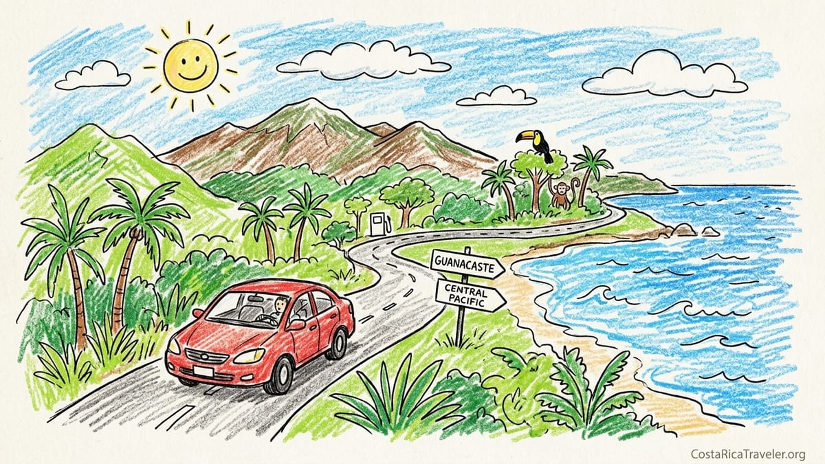
The biggest misconception I carried into this journey was the idea of a seamless coastal highway with the ocean as a constant companion, something like the most famous sections of California’s Highway 1. Costa Rica’s Pacific does not work like that. The beaches of Guanacaste are reached via inland highways and then branch roads. Route 34 forms a critical Central and South Pacific spine between Caldera and Quepos and beyond, but even there, the water appears and disappears rather than lining one side of the pavement for hours. Understanding this early would have helped me set expectations and allocate time more realistically.
I also learned the hard way that trusting navigation apps without adding generous buffers leads to long, tiring days. On my north to south push from Guanacaste to Quepos, I planned around an optimistic drive time that did not fully account for food breaks, fuel stops, grocery runs, parking searches or simply unfamiliarity with local traffic patterns. By the time I found my hotel in Manuel Antonio, found a space on a narrow hillside access road, and checked in, I had been traveling far longer than the map had implied that morning. Next time, I would interpret any suggested time as a base figure, then add at least 30 percent for reality and pad the day accordingly.
Another mistake was letting curiosity pull me onto unplanned rural roads late in the afternoon. At one point, leaving a Guanacaste beach, I followed a tempting “shortcut” indicated by the navigation app that diverged from the main paved route and wound through farmland on a narrower, patched road. The surface remained technically paved, but it was uneven, with patched potholes and occasional loose gravel. As daylight faded, the lack of street lighting and the presence of wandering dogs and cyclists made me acutely aware of how quickly a pleasant drive can turn stressful after dark. From that evening onward, I chose longer but more familiar and better-lit routes whenever I was approaching sunset.
Finally, there was the rental-car category. In the planning phase, I had assumed that the phrase “Pacific coast road trip” meant I would need 4WD. Conversations with rental agents and my actual experience showed that for the specific route I drove from Liberia through Guanacaste beaches, down Route 34 to Quepos and then to Uvita and back, 2WD with good tires was entirely sufficient in normal conditions. Paying more for an SUV with 4WD would have been unnecessary on those surfaces. The money saved by sticking with a sedan could instead go to fuel, guided nature walks or an extra night to break up a long stage.
How I Would Structure the North to South Trip Next Time
Looking back at the entire north to south Pacific journey, I would keep the overall shape but break it into more digestible segments with clearer priorities. Starting at Liberia still makes sense for a Guanacaste-focused opening, especially for travelers wanting time around Papagayo, Hermosa, Coco or Tamarindo. I would give myself at least three nights in one base, perhaps Tamarindo or Flamingo, and treat other nearby beaches as half-day excursions instead of trying to change lodging every day. This would reduce packing and parking time and allow for a better feel of local rhythms.
For the connection from northern Guanacaste to the Central Pacific, I would aim to overnight somewhere around Jacó rather than attempting a direct drive all the way to Quepos in one shot. Leaving Guanacaste early, I could arrive in Jacó by midafternoon even with deliberate stops, check into a hotel with secure parking, walk the beachfront in the evening and then continue on Route 34 to Quepos and Manuel Antonio the following morning. This would align my driving with daylight hours on the visually appealing Caldera to Jacó portion of Route 34 and avoid arriving in a new town after dark.
In the Central Pacific, I would allow at least three nights in the Quepos and Manuel Antonio area, planning driving days where my only segments are short hops on Route 34 or local access roads. From there, a further move south to Uvita or an alternate South Pacific base would deserve another three-night block, again with drives scheduled so that I am firmly parked by late afternoon, long before heavy evening rain or darkness can compound the difficulty of rural roads.
Most importantly, I would consciously distinguish between a “Guanacaste and North Pacific” trip and a “Central and South Pacific” trip, rather than feeling obligated to connect every stretch of coastline in a single vacation. For many travelers, it will make sense to treat northern Guanacaste beaches and the Central Pacific as two separate itineraries, perhaps tied to different international gateways. One visit might use Liberia as a base for Papagayo and Tamarindo, limiting driving mainly to Route 21 and local beach spurs. Another visit might fly into San José, then focus on Route 27 and Route 34 from Caldera through Jacó, Quepos and down to Uvita, leaving the more rugged Osa Peninsula and any genuine 4WD river crossings for a dedicated future adventure.
FAQ
Q1. Do I really need a 4WD vehicle for a Costa Rica Pacific coast road trip?
For the route I actually drove, from Liberia through Guanacaste beaches and then down Route 34 to Quepos and Uvita, a 2WD sedan with good tires was sufficient in dry conditions. I avoided the rougher interior roads of the Nicoya Peninsula and did not attempt routes with known river crossings, so the extra cost of 4WD would not have added real value on this specific itinerary.
Q2. How long does it take to drive from Guanacaste to the Central Pacific around Jacó or Quepos?
From northern Guanacaste beach areas such as Tamarindo or Flamingo to Jacó or Quepos, navigation apps might suggest five or six hours, but in reality it is safer to plan on a full day. Once fuel stops, food breaks, slow trucks and time entering and exiting towns are included, the total door-to-door time can easily stretch to seven hours or more.
Q3. Is Route 34 really a coastal highway that stays next to the ocean?
Route 34, the Costanera Sur, is often promoted for its Pacific views between Caldera and Quepos, but it does not cling continuously to the shoreline. Much of the road runs inland through fields, plantations and small communities, with the ocean visible only in segments. Reaching beaches still requires short signed detours off the main highway.
Q4. What are the road and bridge conditions like on the Pacific route described?
On the segments I drove, the primary highways and main connectors were paved and in generally good condition, with proper bridges over major rivers. Some local hotel-access roads were narrower, steeper or partially gravel, but I did not face any un-bridged river crossings on this itinerary. The roughest surfaces tended to be short stretches near lodgings rather than the highways themselves.
Q5. Is it safe to drive at night on the Pacific side of Costa Rica?
I completed part of my Route 34 drive after dark and found it stressful enough that I would avoid repeating it. Outside towns there is limited lighting, visibility can be reduced by rain, and there may be pedestrians and cyclists without reflective gear near the roadway. It is safer and far more enjoyable to plan driving so that you arrive at new accommodations before dusk.
Q6. How frequent are fuel stations along this north to south Pacific route?
Fuel stations appeared regularly in and near larger towns such as Liberia, Filadelfia, Huacas, Jacó, Quepos and Uvita, but were rare right on secluded beaches. I made a habit of filling up when passing through those hubs rather than waiting until the tank was low, especially before longer stretches on Route 34.
Q7. What were parking and hotel-access roads like in beach towns?
In Guanacaste towns such as Tamarindo and Flamingo, parking was usually in small private lots or along side streets close to the sand, sometimes with attendants charging a daily fee. In Manuel Antonio, many hotels sit on steep hillsides reached by narrow concrete roads with sharp curves and limited space, which can feel tight when meeting oncoming traffic or parking along the edge.
Q8. How should I adjust Google Maps or navigation times for realistic planning?
On this trip, I found that adding at least 30 percent to whatever time the app suggested produced more realistic expectations. That buffer covered fuel and snack stops, slower sections behind trucks, and the time required to navigate local streets, parking lots and hotel driveways at each end of the journey.
Q9. When is a good time of day to drive longer stretches on Route 34?
Starting longer segments early in the morning worked best, both to avoid afternoon storms in the wet season and to ensure I reached my destination well before dark. Morning light also made the most of the scenic portions of Route 34 between Caldera, Jacó and the approaches to Manuel Antonio.
Q10. Should I combine Guanacaste, the Central Pacific and the South Pacific in one road trip?
It is possible to link all three regions in a single north to south journey, as I did, but doing so requires long driving days. With the benefit of experience, I would often recommend splitting them into separate trips, treating Guanacaste and its northern beaches as one itinerary and dedicating another journey to Route 34 between Caldera, Jacó, Quepos and further south toward Uvita and beyond.