

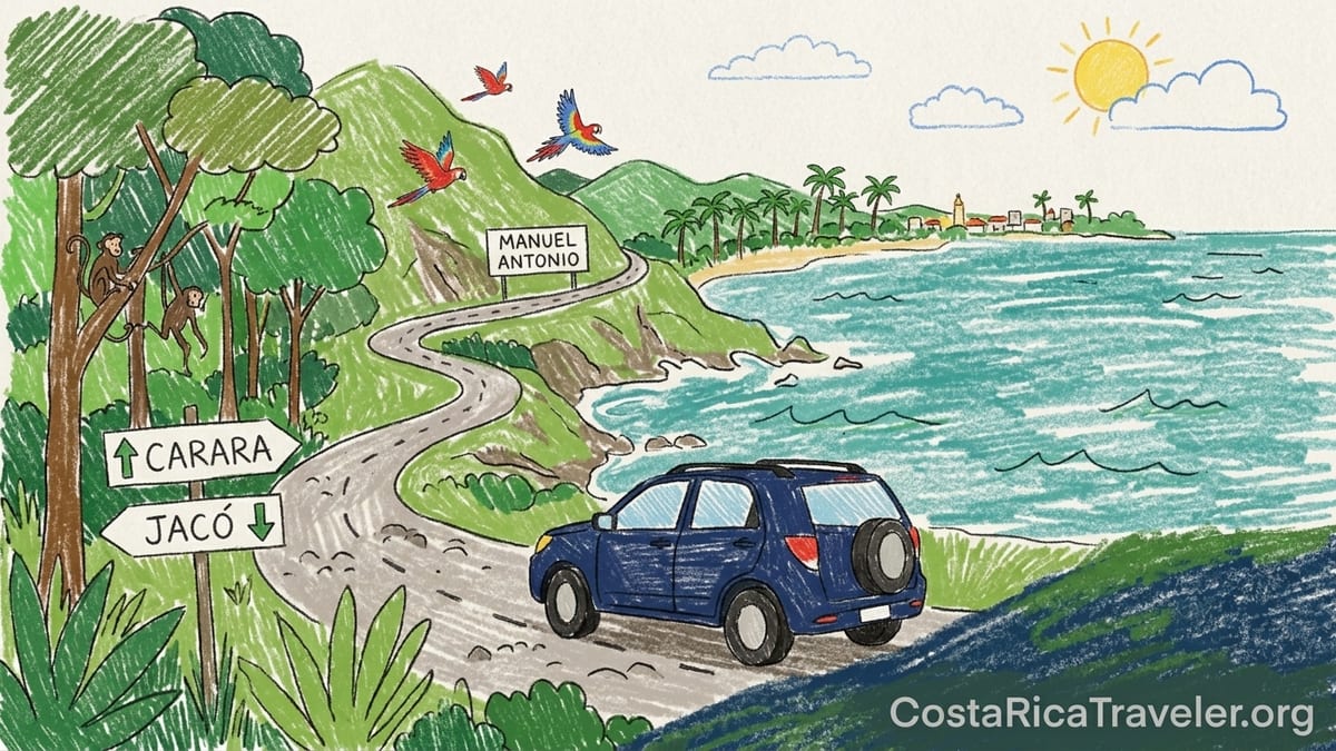
I arrived on the Central Pacific coast with six days, a compact SUV and a head full of Instagram clichés. In my mind it was one long strip of identical palm-lined beaches, easy drives between towns, a quick dip in Manuel Antonio and then back to San José. Instead, traveling overland from Carara to Jacó, then on to Quepos, Manuel Antonio and farther down the Costanera Sur, I discovered a region that shifted every hour: from heavy truck traffic and sun-baked highway shoulders to rain-soaked forest trails, from busy surf towns to almost empty coves where the jungle still presses right against the sand. The Central Pacific is less a single destination and more a string of very different micro-experiences, stitched together by Route 34.
How I Structured My Central Pacific Trip
I started in San José with a rental compact SUV, picking it up near Juan Santamaría International Airport around 9 a.m. and heading straight for Route 27, the toll highway that funnels most traffic toward the Pacific. After the last toll plaza near Atenas, the road threaded into the hills and then dropped toward the coast to meet Route 34, the Costanera Sur. From there my trip formed a rough ladder down the Central Pacific: first Carara National Park, then two nights based near Jacó, followed by three nights around Quepos and Manuel Antonio, with a final exploratory day pushing farther south before looping back inland.
On paper, none of the drives looked long. Google estimated 1.5 to 2 hours from the airport to Jacó, another 1.5 hours to Quepos, and less than an hour more to the quieter beaches to the south. In reality, every coastal transfer took longer. Road construction near key bridges, slow trucks on the Costanera and surprise rainstorms stretched many legs out to three hours door to door, even without big accidents. That gap between the map and the dashboard shaped my entire perception of the region.
I kept my bases simple: a roadside lodge about 15 minutes north of Jacó so that I could hit Carara early, then a small hillside hotel outside central Jacó, and finally a mid-range place near Quepos with parking and decent access to Manuel Antonio. My original plan had been to split the six nights evenly between Jacó and Manuel Antonio, but by day four it was clear I had underestimated how different each area would feel and how tiring coastal driving can be once you factor in heat, rain and traffic.
Before arriving, I pictured flat, easy cruising between beaches and a fairly homogeneous strip of development. The reality involved frequent climbs and descents, curvy sections where trucks stacked up behind slow vehicles, and constant reminders that this is still a wet tropical coast. Rain smudged windshields in the afternoons, road shoulders crumbled into ditches in places, and the humidity wrapped itself around everything, including my expectations.
Driving the Costanera Sur: Road Conditions and Travel Times
The backbone of Central Pacific travel is Route 34, the Costanera Sur. It is a paved primary highway and the official coastal connection between the San José area and the Pacific towns. Traffic moves decently most of the time, but it is not a quick North American freeway. It is mostly one lane in each direction with uneven shoulders, occasional potholes and slow-moving trucks that can back up long lines of cars. Leaving the capital late in the morning meant crawling behind semis for long stretches, especially before and after the junctions with Route 27 and at access roads to popular towns.
Several official works have improved sections of Route 34 in the last few years. South of Dominical, for example, authorities have laid fresh asphalt, widened parts of the surface and renewed road markings over dozens of kilometers between Dominical and Uvita. Those upgrades help with drainage and visibility, but they do not eliminate the effect of heavy rain and occasional landslides farther north, nor do they change the fact that the Tárcoles bridge area is a pinch point when maintenance is underway. Even with better pavement, the limiting factor is often weather, trucks and cautious local drivers.
In practice, the “two-hour” drive from San José airport to Jacó became a three-hour door-to-door slog once I included traffic leaving the Central Valley, a fuel stop and a snail-paced section behind a tanker on the descent toward the coast. The Jacó to Quepos run, listed as about 73 kilometers along Route 34, took me close to two hours due to rain, slow curves and construction near a bridge. Each transfer also involved time inching along local access roads, where steep hills, narrow one-way segments and parked vehicles turned the final kilometers into their own navigation puzzle.
After one particularly long day that combined an early morning hike in Carara, lunch in Tarcoles, a quick stop at Herradura and then the transfer to Quepos, I finally admitted I had planned like someone who had never driven a tropical two-lane highway. The lesson was simple: on the Central Pacific, treating each leg as at least 30 to 50 percent longer than the navigation apps suggest is more realistic, especially in the rainy season or on weekends.
Carara and the Northern Edge: Forest, Heat and Unexpected Accessibility
Carara National Park lies just north of Jacó, straddling the transition between dry forest to the north and humid rainforest to the south. For years I had thought of it as a secondary stop, somewhere you visit only if you have birding gear and a private guide. In reality, it turned out to be one of the most accessible and atmospheric forest experiences on the Central Pacific, with well-marked trails and a surprisingly high chance of seeing wildlife even on a casual visit.
Since late 2023, Carara has required visitors to purchase entry tickets online through the national park system rather than at the gate. Foreign adult tickets are priced in U.S. dollars and must be reserved for a specific date. I booked my visit the night before using the online platform, chose a morning time slot and arrived at the main entrance shortly after opening. Rangers checked my passport against the electronic ticket, reminded me of the rules about staying on trails and not feeding wildlife, and then pointed me toward the universal access loop that snakes through some of the tallest forest on this part of the coast.
The first surprise was the humidity. Even at 8 a.m., the air inside the forest felt denser than anything I had experienced that week. Sweat pooled under my daypack straps within minutes. The second surprise was how quickly wildlife appeared. Without a guide, I saw scarlet macaws screeching overhead, leaf-cutter ant highways crossing the path and a pair of agoutis foraging just off the trail. I heard but did not see howler monkeys deeper in the woods. The trail surface alternated between smooth concrete and compacted gravel, easy enough in regular sneakers. Mosquitoes, which had worried me, were present but manageable with a strong repellent and light long sleeves.
Carara itself felt relatively undeveloped outside the small visitor center and parking area. Yet the immediate surroundings told a different story. The highway just beyond the trees pulsed with trucks; the Tarcoles River bridge a few kilometers north was jammed with tour buses and day-trippers peering down at crocodiles from the rail. That contrast foreshadowed much of the Central Pacific experience for me: small pockets of genuine wildness pressed up against heavily trafficked infrastructure.
Jacó and Surroundings: Busy Beach Town with Pockets of Calm
Jacó was my introduction to how built-up parts of the Central Pacific have become. Driving in on Route 34, a tangle of billboards announced surf schools, sports bars, casinos and condo developments long before I saw the beach. The town’s main strip runs parallel to the ocean, lined with restaurants, small hotels, souvenir shops and nightlife that ramps up on weekends. Between the beach access points I found cracked sidewalks, loud music and surprisingly heavy traffic for a town of its size.
The surf itself on Jacó’s main beach was rough during my visit, with closeout waves and brownish water stirred up by recent rain. Flags posted near the lifeguard stands warned of strong currents, and local instructors kept their beginner groups clustered on the gentler southern end of the bay. This was my first wake-up call about assuming every Costa Rican beach is ideal for swimming. While confident surfers were happy, I found the water less inviting for a casual bob, especially at mid-tide.
Yet just a few minutes outside town, the character changed. North toward Herradura, hotel access roads climbed into the hills, switching from pavement to steep concrete ramps and, in a few cases, short gravel stretches with potholes. My hillside lodge sat at the end of one such road, which felt perfectly passable in a small SUV but would have been unnerving in a low sedan on a wet night. Parking was tight and required backing into a narrow space between a wall and a drainage ditch. At night, frogs and insects drowned out the distant bass from Jacó’s bars, and a chorus of geckos took over my room walls.
What Jacó did exceptionally well was convenience. There were dozens of restaurants within a five-minute drive of town, from soda-style local spots serving casados for moderate prices to pizza, sushi and vegetarian cafes. Groceries, pharmacies and ATMs were abundant. The trade-off was that Jacó felt more like a small city than a tranquil beach town, especially in the evening when loud music and party crowds spilled onto the sidewalks. After two nights, I was grateful for the services but ready to move on.
Quepos and Manuel Antonio: Crowded Trails, Wild Encounters
From Jacó I drove south to Quepos, the gateway town for Manuel Antonio National Park. The road there followed the coast through palm plantations and small villages before climbing and dipping along forested ridges. Approaching Quepos, traffic thickened again, especially around intersections where buses, trucks and taxis all jostled for space. The town itself felt compact and busy: a marina, grid of streets, mercado, banks and bus station compressed into a tight bayfront area.
My hotel sat on the hillside road that winds between Quepos and Manuel Antonio. This is where I made one of my biggest planning mistakes. Seduced by jungle views in the photos, I had chosen a property with ocean panoramas but no sidewalk and limited restaurant options within walking distance. At sunset it felt magical to watch scarlet macaws wing overhead and white-faced capuchin monkeys hop across the power lines. At dinner time, it felt much less magical to drive up and down a steep, dimly lit road in search of meals, competing with shuttle vans and delivery scooters for parking at popular spots.
Visiting Manuel Antonio National Park itself required more logistics than any other stop on my trip. The park operates on an online-only ticket system managed by the national conservation agency. Foreign adult entry is priced in U.S. dollars plus tax, with timed entry slots and daily limits. Tickets must be purchased in advance on the official platform; you cannot buy them at the gate. At the entrance, rangers compared the QR code on my phone to my passport, checked that the name matched and reminded me that food was restricted to certain snack items in sealed containers. Glass, alcohol and feeding animals are prohibited inside the park.
Despite the layers of control, Manuel Antonio remains one of Costa Rica’s most visited parks and it feels like it. On my chosen morning, a steady stream of guided groups filed along the main trail, telescopes aimed at sloths, frogs and monkeys. Yet even with the crowd, wildlife was remarkably easy to see. Within the first hour I had spotted two sloths, one howler monkey, several capuchins and more iguanas than I could count. The beaches inside the park, especially Playa Manuel Antonio, were postcard-beautiful with white sand and turquoise shallows. Rip current warnings still applied, and lifeguards kept watch, but compared with Jacó the water here felt calmer and clearer on the day I visited.
By midday the humidity spiked, the sun became brutal in the open sections, and my mistake in underestimating the heat became obvious. I had brought only a small water bottle, assuming I could fill up easily, and ended up queuing at one of the park’s drinking fountains with other underprepared visitors. Between the heat, hills and crowding it was one of the most exhausting days of the trip, yet also one of the most rewarding in terms of wildlife and scenery. If I were to repeat the itinerary, I would allocate at least two full days around the park itself and plan a complete rest afternoon at the pool afterward.
Quieter Beaches and the Southern Edge of the Region
South of Quepos and Manuel Antonio, the Central Pacific begins to loosen up. Towns stretch farther apart, traffic thins and the rainforest seems to close in around smaller, emptier beaches. Driving this section of the Costanera Sur, I encountered fewer billboards and more stretches of unbroken palm plantations, river crossings and glimpses of coastline. Sections benefited from upgraded pavement and fresh road markings, yet even here the driving was more time-consuming than the distances suggested due to curves, lower speed limits near villages and rain showers that swept in during the afternoon.
Pulling off to explore minor beaches reinforced how variable coastal access can be. Some turnoffs were well-signed, connecting directly to small parking areas near the sand, where informal attendants watched over cars for a modest fee. Other access roads quickly deteriorated from asphalt to rutted dirt, with puddles and exposed rocks after a recent storm. In a taller vehicle I felt reasonably comfortable picking my way through, but in a sedan or during peak rainy months, some of these spurs would be better left alone.
The beaches themselves ranged from broad, empty arcs of dark sand with powerful surf to sheltered coves framed by rock outcrops. At one stop, warning signs mentioned rip currents and posted no-lifeguard notices. At another, where a small cluster of guesthouses lined the back of the beach, local families swam in gentle waves while pelicans dove just offshore. In contrast to Jacó and Manuel Antonio, restaurant choice here shrank dramatically. In one village, I had only two obvious options for lunch; both offered fresh fish, rice and beans at sensible prices, but closed early in the evening. Travelers relying on walking to dinner from remote lodgings in these quieter pockets could easily find themselves driving longer distances at night than they expected.
What struck me most about the southern edge of the Central Pacific was how wild it still felt in places. Monkeys crashed through trees near roadside sodas. Scarlet macaws flew low over cattle pastures. In the late afternoon, the combination of mist rising from the forest and low angled light across the water created a sense that the highway was just a temporary scar in a much older landscape. It was a very different mood from the neon of Jacó or the busy trail network of Manuel Antonio.
Weather, Seasons and Small but Important Mistakes
Throughout my week on the Central Pacific, the rhythm of the weather dictated what was realistic each day. Mornings tended to be clearer with softer light and slightly lower humidity, which made them perfect for hikes in Carara and Manuel Antonio. By early afternoon, especially during the wet season months, heavy clouds built over the hills and unleashed intense showers that pounded both forest canopies and tin roofs. Driving in those conditions was draining: visibility dropped, road markings blurred under sheets of water and large puddles formed where drainage was imperfect.
One of my key mistakes was assuming that showers would be light and brief. On the day I tried to combine a long hike in Manuel Antonio with a late-afternoon drive south to scout additional beaches, the rain arrived early and stayed. The “quick” coastal reconnaissance turned into a tense hour-and-a-half crawl, wipers at full tilt, watching for hidden potholes under pooled water. That experience changed how I planned the rest of the trip: all substantial drives moved to early or mid-morning slots, and I accepted that some afternoon aspirations simply would not fit comfortably.
Heat and humidity were the other underappreciated challenges. Even in so-called shoulder months, mid-day temperatures along the Central Pacific feel significantly hotter once you combine strong sun, reflective sand and saturated air. Simple walks from parking areas to viewpoints left my shirt soaked. Several lower-elevation hotels had only fans, not full air conditioning, which is fine for acclimated travelers but can be tough on those just off a plane. I found mosquito levels moderate overall; they were most noticeable near standing water and under thick vegetation at dusk. Using repellent, wearing lightweight long sleeves in the forest and keeping balcony doors closed in the evening kept bites to a minimum.
Finally, I overestimated how easy it would be to string multiple activities together in a single day. My first itinerary draft had me visiting Carara at opening, having lunch at the Tarcoles bridge, checking into a new hotel in Jacó and then catching sunset at a viewpoint south of town. On the ground, between slower highway speeds, parking searches and the simple drag of moving luggage in the heat, that day ended in exhaustion rather than satisfaction. Over time I adjusted: one main activity or transfer in a day, plus short, flexible add-ons, proved to be the sweet spot for actually enjoying the Central Pacific instead of just rushing through it.
What I Would Do Differently Next Time
Looking back, my biggest structural misstep was time allocation. I gave Jacó two nights and Manuel Antonio only three, thinking the park might feel like a one-day check-box. In reality, I would reverse that balance or even drop one of the Jacó nights in favor of more time around Quepos and the quieter beaches to the south. Manuel Antonio and Carara both rewarded early starts and unhurried pacing. I wished for an extra morning just to sit with coffee on the hillside above Quepos watching macaws and capuchins pass by.
I would also choose lodgings with better walking access to food. In Jacó, staying closer to the main strip would have made evenings simpler, even at the cost of more noise. Around Manuel Antonio, I would pick a place directly on the bus route between Quepos and the park entrance, within a short walk of at least two or three restaurants. That small convenience changes how trapped you feel at night, especially if you prefer not to drive steep, narrow roads after dark.
On the practical side, I would book national park tickets earlier, especially for Manuel Antonio. In higher-demand months, morning time slots can sell out days in advance, and the park enforces per-day and per-transaction limits through its online platform. Having a confirmed entry and printed or downloaded QR code, along with passport in hand, made my visit straightforward, but I saw more than one traveler turned away at the gate because they had assumed tickets were sold on site. For Carara, which now also uses the online system, reserving the first time slot of the day provided noticeably cooler temperatures and quieter trails.
Most importantly, I would mentally treat the Central Pacific as several distinct zones rather than one homogeneous region. The Jacó area is best for those who want services, nightlife and surf town energy. Carara and its surroundings are about dense forest and birds. Quepos and Manuel Antonio mix wildlife-rich parkland with heavily visited beaches and a busy tourism strip, while the southern edge offers glimpses of a wilder, less built-up coast. Understanding that diversity up front makes it easier to pick two or three bases that match your priorities instead of trying to “do it all” in one quick sweep.
The Takeaway
Traveling through Costa Rica’s Central Pacific by road taught me that this is not a single beach destination but a layered corridor where infrastructure, forest and ocean constantly compete for space. The same Route 34 that carries semi trucks and buses between San José and the coast also serves as the thin thread connecting national parks, resort strips, working towns and half-hidden coves. Distances look short on the map, yet heat, humidity, traffic and weather all stretch them out in practice.
Along the way, the region revealed a spectrum of experiences. Carara’s dark, breathing forest offered early-morning birds and a tangible sense of wildness, even with the highway humming just beyond the tree line. Jacó traded quiet for convenience, packing restaurants and services into a walkable strip beside a surf beach that, on some days, felt more suited to boards than to swimmers. Manuel Antonio demanded the most planning with online tickets and timed entries, but rewarded that effort with close-up wildlife sightings and some of the most photogenic beaches on the coast. South of Quepos, the landscape dialed back the development and hinted at how the Pacific must have looked before large-scale tourism took hold.
Answering the question of what it is actually like to travel through the Central Pacific as a region means accepting its contrasts. You drive from crowded crocodile viewpoints on highway bridges to empty stretches of sand where your only company is a pair of scarlet macaws. You shift from air-conditioned hotel lobbies and international menus to simple roadside sodas where the ceiling fans barely keep up with the humidity. You learn to respect the rain, build in buffers for every transfer and stop assuming that any two beaches, no matter how close on the map, will feel or function the same.
If you come to the Central Pacific willing to slow down, factor in the friction of the road and treat each base as its own distinct experience, the region opens up generously. It becomes less about checking off Jacó or Manuel Antonio and more about experiencing the tension between wild and developed that defines this stretch of Costa Rica’s coast. In that tension lies the Central Pacific’s true character, and it is best discovered with a half-full itinerary, an early alarm and the flexibility to let one good beach or forest trail quietly fill an entire day.
FAQ
Q1. Do I need a 4x4 to drive the Central Pacific coast?
For Route 27 and Route 34 between San José, Jacó and Quepos, a regular car or small SUV is usually enough, but some hotel access roads and minor beach turnoffs are steep or rough, so extra clearance is helpful.
Q2. How long does it really take to drive from San José airport to Jacó?
In light traffic it can be around two hours, but once you factor in toll stops, trucks, possible construction and a fuel or snack break, three hours door to door is a safer estimate.
Q3. Is Jacó a good swimming beach for families?
Jacó’s main beach can have strong waves and rip currents, so it is better for confident swimmers and surfers; families often prefer gentler nearby beaches or choose calm days and stay near lifeguard stands.
Q4. How do I buy tickets for Manuel Antonio National Park?
You must purchase tickets in advance through the national park online system for a specific date and entry time, then present the QR code along with your passport at the gate.
Q5. Do I also need reservations for Carara National Park?
Yes, Carara now uses the same online ticketing platform for dated entries, and it is wise to reserve the first morning slot for cooler temperatures and better wildlife activity.
Q6. When is the best season to visit the Central Pacific?
The drier months offer more consistent sunshine and easier driving, while the wetter months bring lusher forest and fewer crowds but also heavier afternoon rain and occasional road disruptions.
Q7. Are mosquitoes a big problem along the Central Pacific?
Mosquito levels vary by location and season; they are most noticeable near forest and standing water at dawn and dusk, so repellent and light long clothing are usually sufficient protection.
Q8. Is it safe to drive between Jacó and Manuel Antonio after dark?
The highway is paved, but limited lighting, rain, curves, slow trucks and occasional animals on the road make daytime driving much more comfortable for visitors unfamiliar with local conditions.
Q9. How many days should I spend in the Central Pacific region?
With five to seven nights you can reasonably combine time around Jacó, Carara and the Quepos and Manuel Antonio area without rushing, while shorter stays work best if you focus on just one base.
Q10. Can I rely on public buses instead of renting a car?
Public buses do connect San José, Jacó, Quepos and Manuel Antonio, but they add travel time and reduce flexibility, so many travelers still prefer a rental car or prebooked shuttles for this region.