


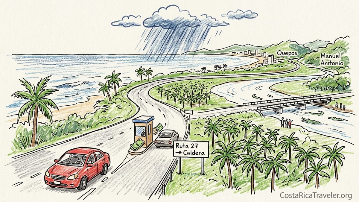
I drove Costa Rica’s Central Pacific coastal road the way most visitors actually do it: jet-lagged from San José, in a modest 2WD rental, learning in real time what route descriptions never quite capture. This is what it was really like to collect the car, navigate Route 27 and Route 34 from the Caldera area down to Quepos and Manuel Antonio, and how I would structure the trip differently next time.
Starting in San José: Rental Reality at SJO Airport
I picked up my car at Juan Santamaría International Airport, near San José, using one of the well-known local agencies that travelers often recommend at SJO for clearer pricing on mandatory insurance. The shuttle from the terminal to the off-airport lot took about ten minutes in early afternoon traffic. I had reserved a compact 2WD sedan, not an SUV or 4x4, specifically to see how a normal car would handle the Central Pacific coastal route that the tourism board promotes between the Caldera area and Quepos. The rental desk staff confirmed that a 2WD would be fine for the main highways and for typical hotels around Jacó and Manuel Antonio, as long as I avoided a few notorious back roads after heavy rain.
Insurance was the first hard lesson. In Costa Rica, third-party liability coverage is mandatory and cannot be declined, even if your credit card covers collision. The base daily rental rate I had seen online almost doubled once the legally required liability and the agency’s basic collision damage waiver were added at the counter. A hold of several hundred US dollars was placed on my credit card as a security deposit, which is standard around SJO. Talking with other renters in line, I heard similar stories: anyone arriving with only the headline online rate was surprised by the final total once coverage and taxes were added.
Fuel was straightforward, but it pays to understand the routine before you drive away. The car was supplied with a full tank and the contract required me to return it full. Gasoline prices at the time were broadly in line with what you would expect in Central America, and stations accept both colones and US dollars, though change usually comes in colones. I used a nearby station just west of the airport to top off a few days later instead of waiting until the final exit, which helped avoid last-minute stress in San José traffic.
I left SJO in mid-afternoon on a weekday, aiming to reach the coast the same day. That timing shaped much of the drive that followed. San José’s rush hour builds between about 3:30 and 6:30 pm, and although the navigation apps suggested a three-hour drive to Quepos via Route 27 and Route 34, I quickly learned those estimates did not account for toll queues, lane restrictions, and slow trucks on the final approach to the coast.
San José to Caldera on Route 27: Tolls, Traffic and Timing
The first leg was Route 27, the toll highway running from the greater San José area to the Caldera region on the Pacific side. This is the fastest corridor to reach the Central Pacific beaches. I joined Route 27 west of the capital and immediately hit dense but flowing traffic. On paper the distance from the western suburbs of San José to the Caldera turnoff is little more than an hour, but that assumes light traffic and minimal delays at the multiple toll booths that line the route.
There are several cash toll plazas on Route 27 between San José and Caldera. I kept small denomination colones ready in the center console, which helped avoid fumbling at the window, but even so, late afternoon lines at a couple of booths added 10 to 15 minutes each. Drivers with an electronic QuickPass transponder moved more quickly through dedicated lanes, but rental cars rarely come with that option by default unless you specifically request it. The booths still accept cash, and staff handed back change through the window without issue.
Road surface on Route 27 was uniformly paved and in good shape. The bigger factor was traffic density and speed. Long sections have a posted speed limit that feels conservative to foreign drivers used to wide freeways, yet locals frequently drive much faster. I had to resist the temptation to follow their lead, especially in sections where tight curves and slow trucks appeared with little warning. From SJO to the Caldera area it took me just under two hours of steady driving, including toll delays, rather than the optimistic hour and a quarter that navigation first predicted.
Wind and rain are worth mentioning for this section, especially outside the dry months of December to April. On my outbound drive in the shoulder of the rainy season, skies were clear leaving San José, but dark clouds rolled in near the highest points of the highway. A brief downpour reduced visibility enough that I slowed considerably, switched on headlights, and increased my following distance. This was a preview of what afternoon showers can look like later on the coastal section.
Joining Route 34 at Caldera: The First Glimpse of the Coast
Near Caldera the highway transitions toward the acclaimed scenic coastal road, Route 34, also known as the Costanera Sur. Signage for the junction is visible but not excessive, and I almost missed the correct exit on my first attempt. A last-minute lane change solved the mistake, but it would have been easy to overshoot and add an unnecessary detour back toward Puntarenas. Having downloaded an offline map before leaving San José made a difference, since mobile data coverage briefly dropped right when I wanted to confirm the turn.
From the Caldera connection, Route 34 begins to feel convincingly coastal. The road is still a paved highway, generally wide enough for two clear lanes, but it loses the limited-access feel of Route 27 and starts to interact with small towns, side roads, and local traffic. Heavy trucks continue along this corridor because it links the central valley with agricultural areas and port facilities further south, so overtaking zones become an important part of the driving rhythm.
The pavement between the Caldera area and Jacó was mostly smooth when I drove it, with only a few patches of shallow potholes near construction zones. Official sources have highlighted ongoing maintenance and resurfacing works on segments of Route 34 in recent years, especially further south between Dominical and Uvita, and the benefits of that were visible even in the Central Pacific stretch. Painted lane markings, new reflectors and fresh asphalt were common sights, particularly south of the busy Carara National Park area.
Actual driving time from the Caldera junction to Jacó was about one hour for me, including a short roadside stop near the famous bridge over the Tárcoles River, where travelers gather to spot crocodiles below. This stop was my first lesson in coastal road timing: parking near the bridge shoulder was tight, with cars edging onto gravel and pedestrians walking along the guardrail. It is an atmospheric pause but not a quick one, and re-entering traffic required patience as buses and trucks passed in bursts.
On the Costanera Sur: Caldera to Quepos and Manuel Antonio
The heart of the drive, and the section that tourism material often describes as the Central Pacific coastal route, runs from the Caldera area south through Jacó, Herradura, Parrita and on to Quepos and Manuel Antonio on Route 34. In daylight and in decent weather, a 2WD sedan handled this paved highway perfectly. The road is sealed the entire way and lane widths generally felt comfortable. My main constraints were speed limits, town traffic and my own tendency to overload the day with too many spontaneous stops.
From Jacó, my plan was ambitious: a coffee in town, a walk on Herradura beach, a quick swim at Playa Hermosa, then continue straight to Manuel Antonio for sunset. The reality was slower. Jacó’s beachfront streets filled with pedestrians and delivery trucks by late morning, and finding a legal parking spot near the sand took longer than expected. I paid a local parking attendant a small tip to watch the car, which is common along this coast, although formal pay lots are increasingly available near the main strips.
Past Jacó, Route 34 threads past turnoffs for lesser-known beaches and private developments, many of them accessed by short but steep side roads. When I detoured toward one hillside hotel near Playa Hermosa, I discovered the biggest limitation of a small 2WD: the final access ramp was paved but very steep, with a tight curve. In dry conditions the car climbed it in first gear, but I could see how a wet surface or loose gravel on a similar slope further south might leave a compact sedan spinning. For my actual overnight stops around Jacó and later at Manuel Antonio, I chose accommodations with paved, reasonably graded access and marked parking areas, which removed that stress entirely.
Between Parrita and Quepos the road felt at its most relaxed. Long straight stretches of asphalt crossed palm plantations and low bridges over rivers. Yet even there, traffic patterns mattered. By early Friday afternoon, vehicles heading toward the beach built steadily: San José residents beginning their weekend and delivery trucks rushing to finish routes. The advertised travel time from Jacó to Quepos was about one hour and fifteen minutes, but with slow sections behind buses and cautious overtakes, it took me closer to an hour and forty minutes without any formal stops. The highway surface was good; it was human traffic that stretched the clock.
Bridges, Construction Zones and Fuel Stops on Route 34
One of my questions before setting out was how bridges and construction might affect the Central Pacific drive. Route 34 includes several bridges over major rivers, and at least one of them near the Río Tárcoles has undergone structural reinforcement and lane restrictions in recent years. On my drive, this work translated into narrowed lanes, temporary barriers and, at peak moments, alternating one-way traffic controlled by flaggers or temporary signals. At midday the delay was manageable, but I noted how a long queue could easily form here during Sunday evening return traffic to San José.
Further south, continued resurfacing and maintenance have kept the Costanera Sur in better shape than its reputation from a decade ago. Official road authority updates have described new asphalt and thermoplastic markings on key segments, and that matched what I saw between Quepos and the start of the Southern Zone. Still, short work zones appeared with uneven shoulders, temporary gravel patches and workers on the margins. A 2WD was perfectly adequate across these, but I lowered my speed each time and resisted the temptation to follow locals overtaking aggressively around cones.
Fuel availability along the Central Pacific is good. I encountered full-service gas stations around Orotina, near Jacó, close to Parrita and just outside Quepos. Most accepted major credit cards and cash. I chose to refuel in Parrita on my southbound leg to keep the tank above half, which simplified decisions later in the day and avoided hunting for a station near dusk. Station forecourts are usually well lit and paved, but entrances can be sharp, especially when turning across traffic from the highway.
Parking at beaches and in towns was a mix of formal and informal. In Jacó and Quepos, some hotels and businesses offered gated lots. At more casual stops, such as Playa Hermosa and smaller roadside miradores, people parked on widened gravel shoulders or informal clearings. I always avoided leaving valuables visible in the car, even for a quick photo stop. Evening parking in Quepos filled quickly on Friday and Saturday nights, so arriving before sunset gave me more choice and allowed me to avoid tight parallel spots on steep streets.
Weather, Night Driving and Navigation Mistakes
The Central Pacific region has a marked dry season from about December to April, with warmer, sunnier conditions and relatively predictable afternoons. Outside those months, especially from May to November, heavy showers are common, and September and October can bring particularly intense Pacific rain. On my drive in the shoulder of the wet season, I experienced the classic pattern: blue skies in the morning and a dramatic downpour around 3:30 pm that cut visibility, created standing water in low spots, and slowed traffic to a cautious crawl.
During one such storm between Parrita and Quepos, wipers at full speed barely kept up. The reflective lane markers and fresh road paint on resurfaced sections helped, but the spray from trucks reduced visibility ahead to just a few car lengths. In these moments, the quality of the tires and brakes on a simple 2WD sedan mattered far more than whether it had four-wheel drive. I kept headlights and hazard lights on, stayed behind a bus whose taillights provided a reference point, and eased my speed well below the posted limit until rain intensity dropped.
I made two navigation mistakes worth noting. The first was missing the exit from Route 27 toward the coastal connection near Caldera, almost continuing toward Puntarenas. There was a turnaround option a few kilometers ahead, but it added around twenty minutes and some unnecessary stress as trucks bore down from behind. The second mistake came near Jacó, where I followed a side road uphill assuming it would loop back to the highway. Instead it deteriorated into a patched, partially washed-out lane serving hilltop homes. Although still passable in 2WD, the combination of steep gradients, uneven surface and blind corners convinced me to turn around in a driveway rather than push onward.
Night driving on this route is technically possible but not something I would recommend as a first-time visitor. On my inbound day I underestimated Friday coastal traffic and rolling delays at tolls and construction zones. Dusk arrived as I approached Quepos, and by the time I climbed the winding road toward Manuel Antonio, it was fully dark. Headlights from oncoming vehicles, occasional pedestrians on the roadside, and narrow shoulders combined to make the last half hour more tiring than the previous three. If I repeated the itinerary, I would prioritize arriving at each coastal town by mid-afternoon at the latest, both for safety and for the enjoyment of seeing the scenery in daylight.
Where 2WD Was Enough and Where 4WD Would Help
Across the entire Central Pacific corridor between the Caldera area and Quepos, the main highways I drove were well within the comfort zone of a standard 2WD sedan. Route 27 and Route 34 are paved, patrolled and actively maintained. In dry conditions, and with reasonable driving habits, a small car handled lane changes, highway speeds and moderate rain without problem. For many visitors whose plans stay on this axis and involve hotels directly on or just off the highway, a 2WD is genuinely sufficient.
The situations where I briefly wished for a 4WD vehicle all involved side roads and hotel access drives rather than the coastal highway itself. One contender was the steep entrance to a hillside hotel near Playa Hermosa, where the grade and tight curve required careful throttle control in first gear. Another was a muddy, rutted track toward a more remote beach access south of Parrita after a storm, where puddles obscured the depth of holes. In those cases, I either backed out carefully or chose a different, paved access point. A higher-clearance SUV with four-wheel drive would have provided more margin in wet or eroded conditions, especially during the peak rainy months of September and October.
In Quepos and Manuel Antonio, many of the boutique hotels and rental villas cling to hills overlooking the ocean. Access roads are often paved but can be very steep with sharp switchbacks and limited run-out. My 2WD sedan climbed them, but I planned approaches to maintain momentum and avoided stopping in the steepest mid-slope sections. When booking accommodation in this area, it is worth reading recent reviews that mention road access and parking. Several properties explicitly note that 4x4 is recommended or at least helpful for reaching their gates comfortably in all weather.
One clear pattern emerged: the more spontaneous and off-the-beaten-path I wanted the beach or viewpoint to be, the more a 4WD would have turned mild anxiety into straightforward exploration. If your itinerary includes only Jacó, the main beach in Manuel Antonio, and well-known lookouts, then 2WD is adequate. If you expect to chase hidden coves, drive into the foothills in wet season, or tackle unpaved segments beyond the main Central Pacific corridor, upgrading to an SUV becomes less of a luxury and more of a practical investment.
Mistakes I Made With Stops, Parks and Weekend Traffic
My biggest planning mistake was packing too many stops into a single day between San José and Manuel Antonio. On my outbound leg I attempted to drive from SJO, visit the Tárcoles bridge, wander Jacó’s beachfront, swim at Playa Hermosa, and still reach Manuel Antonio early enough to scout the national park entrance for the next morning. The combination of San José departure delays, Route 27 tolls, photo stops and slow Friday traffic meant that by the time I rolled into Quepos it was nearly dusk, not mid-afternoon as I had hoped.
This overloading had a knock-on effect. The next morning I arrived at the entrance to Manuel Antonio National Park later than ideal. During the popular dry season months, the park operates with strict daily capacity limits and often sells out early in the day, especially on weekends and holidays. Even in shoulder season, arriving mid-morning meant I joined a longer line and found parking further from the gate, paying a private lot attendant to guide me into a tight space between buses. Had I cut one or two beach stops the previous day and reached the area earlier, I could have scouted parking and ticket options more calmly and planned a dawn arrival at the gate.
Weekend traffic patterns were another underestimation. Friday afternoon saw a tide of vehicles leaving the Central Valley for the coast, and Sunday afternoon brought the reverse. Between Jacó and Orotina, and again near the toll stations on Route 27, speeds dropped substantially as cars merged and queued. Locals budget several extra hours for these return journeys at the end of a weekend, and official advisories sometimes urge drivers to plan around peak hours. I learned this firsthand when my Sunday return to San José took more than an hour longer than the outbound leg, despite no major accidents or closures.
I also underestimated how much time each “quick stop” along Route 34 really consumed. Pulling off to admire a viewpoint or duck down to a beach added far more than five minutes once I counted parking, securing the car, walking to the shoreline, and then easing back into highway traffic. Over the course of a day, four or five such pauses quietly transformed a theoretically three-hour drive into a much longer undertaking. The scenery justifies stops, but structuring them realistically is crucial to arriving before dark and keeping stress levels down.
The Takeaway: How I Would Drive the Central Pacific Route Next Time
If I were to repeat this Central Pacific road trip, starting again from San José and focusing on the genuine coastal route between the Caldera area and Quepos, my structure would be simpler and more forgiving. On day one, I would aim to leave the airport or downtown San José no later than mid-morning on a weekday, giving myself ample time to clear the city, manage Route 27 tolls without rushing, and reach Jacó by early afternoon. I would plan just one extended stop on the way, either at the Tárcoles bridge or at a single beach, not both.
I would then stay one night in or near Jacó or Playa Hermosa, choosing accommodation with straightforward paved access and on-site parking. That would give me daylight to explore the immediate coastline on foot, enjoy sunset without needing to drive afterward, and adjust to local driving rhythms. On day two, I would depart Jacó mid-morning and continue steadily along Route 34, skipping small impulsive detours, and head directly to Quepos and Manuel Antonio, arriving by early afternoon to settle into lodging and walk the hilltop roads before dusk.
For Manuel Antonio National Park, I would pre-purchase or confirm entry details, park as close as feasible, and arrive right at opening time the following morning to reduce both heat and crowds. After that, if I wanted to explore quieter beaches further south or inland waterfalls, I would dedicate separate days to those drives rather than tacking them onto transit days. In rainy season, I would schedule most driving between 8 am and 2 pm, leaving the late afternoon window free for showers to pass while I was already off the road.
Most importantly, I would still feel comfortable renting a 2WD for this exact coastal corridor, with the caveat that I would stick to main paved routes and choose hotels with light or moderate access roads. If I intended to chase remote viewpoints or visit properties clearly described as requiring 4x4, I would upgrade accordingly. The Central Pacific coastal drive from the Caldera area down to Quepos remains one of Costa Rica’s great road experiences, but it rewards unhurried pacing, realistic daily distances, and a willingness to trade one more impromptu beach stop for the calm of arriving at your next destination before dark.
FAQ
Q1. Is a 2WD car really enough for the Central Pacific coastal route between Caldera and Quepos?
A standard 2WD is enough for the main paved highways, towns and most hotels along Route 27 and Route 34. The need for 4WD usually appears only on steeper hotel access roads, unpaved side tracks to remote beaches, or during the wettest months when mud and erosion affect minor roads.
Q2. How long does it actually take to drive from San José to Jacó and then on to Quepos?
In real traffic, expect about two hours from the San José area to Jacó via Route 27 and the Caldera connection, and around ninety minutes from Jacó to Quepos. On busy Friday afternoons or Sunday returns, each leg can easily stretch by an additional 30 to 60 minutes because of congestion and toll queues.
Q3. Are there many tolls on the way from San José to the Central Pacific coast?
Yes. The main tolls are on Route 27 between San José and the Caldera area. There are several plazas that charge modest amounts, usually payable in cash. Keeping small bills and coins ready in the car speeds things up, and some lanes accept electronic passes that most rental cars do not include by default.
Q4. What are the road conditions like on Route 34 between Caldera and Quepos?
Route 34, the Costanera Sur, is fully paved on this stretch and in generally good condition, with sections that have been resurfaced and clearly marked in recent years. You may encounter short work zones, narrow bridges and occasional potholes near construction, but the overall driving experience is comfortable in a regular sedan.
Q5. Is it safe to drive this route at night?
While many locals do, it is not ideal for first-time visitors. Limited lighting, narrow shoulders, lane restrictions at some bridges and heavy truck traffic make night driving more tiring. Whenever possible, plan your travel so you arrive at Jacó, Quepos or Manuel Antonio by mid-afternoon and avoid being on the highway after dark, especially in heavy rain.
Q6. How often will I find gas stations along the Central Pacific route?
Gas stations are reasonably frequent. You will pass options near the outskirts of San José, around Orotina, close to Jacó, near Parrita and near Quepos. Most are full-service and accept credit cards and cash. Keeping the tank at least half full and refueling at major towns reduces any worry about running low.
Q7. Do I need to worry about parking security at beaches and viewpoints?
Parking ranges from formal paid lots in towns and near popular beaches to informal roadside shoulders at smaller stops. It is wise not to leave valuables visible in the car and to use gated or staffed parking where available. Many travelers tip informal attendants a small amount to keep an eye on vehicles during short visits.
Q8. What is the best time of year to drive the Central Pacific coastal route?
The driest months from about December to April offer the most predictable weather and best visibility, which suits first-time drivers. The rainy season from May to November brings greener landscapes but also heavy afternoon showers and, in September and October, some of the heaviest Pacific rains, which can affect minor roads and visibility.
Q9. How bad is Friday and Sunday traffic on this corridor?
Friday afternoons often see a surge of vehicles leaving the Central Valley for the coast, slowing traffic near toll plazas and junctions. Sunday afternoons bring the reverse, with queues especially on Route 27 heading back toward San José. Allow at least one extra hour on these days, and consider driving earlier in the day to avoid the heaviest flows.
Q10. If I could change one thing about my original coastal route plan, what would it be?
I would schedule fewer stops and more time. Specifically, I would break the journey into at least two easy days, with one overnight near Jacó and another in Manuel Antonio, and resist squeezing in multiple extra beach visits on the same transit day. That change alone would have reduced stress, avoided night driving, and made the most of the Central Pacific scenery.