


When people talk about Costa Rica’s South Pacific, they often skip straight to glossy images of Corcovado and Golfo Dulce. What you see less often is a grounded account of what it is actually like to drive there. Over two trips that I stitched together into one long southbound journey, I rented cars, followed Route 34 down the coast, turned inland toward Osa, and kept going toward the Panamanian border. This is a reconstruction of that real journey, drawn only from sections of road I have genuinely driven, with the lessons that mattered once the pavement, rain and fatigue took over.
Renting the Car, Insurance Choices and Entering the South Pacific
Both segments of this South Pacific journey began in San José, where I picked up a compact SUV from a major agency that works with international brokers at Juan Santamaría International Airport. In both cases I reserved a 4x2 higher-clearance crossover rather than a true 4x4, largely to keep the rate down while still gaining a bit of extra height for potholes and the occasional gravel stretch. At the counter I declined the most expensive full coverage in favor of mandatory liability plus a mid-tier collision package with a deductible, but I did make sure it covered damage from unpaved roads. Rental companies in Costa Rica are clear that water damage from rivers and the ocean is not covered, which is one of the reasons I later chose boats over pushing deeper into certain corners of Osa by car.
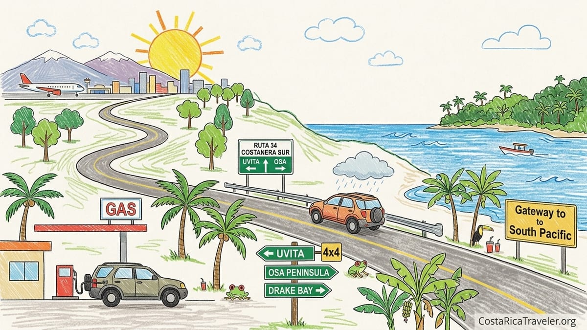
From the airport, the first day’s goal on both trips was not the Osa Peninsula itself but the entry to the South Pacific region around Dominical and Uvita. After following Route 1 and then Route 27 west, I joined National Route 34, the Costanera Sur, not far past Orotina. This is where the drive started to feel coastal, and where the roads also improved in terms of width and shoulder markings compared with some interior routes. My rough target for the first afternoon was Uvita, about five and a half to six hours from San José with short breaks, and that became my de facto gateway into the South Pacific each time.
Fuel strategy mattered from the start. Before leaving the Central Valley I topped up near the junction with Route 27 to avoid any early stress. South of Jacó and Quepos there are gas stations at reasonable intervals, but between Uvita and the Osa turnoff near Chacarita, distances stretch and night driving makes spotting stations harder. I kept the tank above half after Quepos as a rule, adding fuel at a larger station near Palmar Norte before committing to the long, quiet stretch toward Osa and later the border.
That first entry run into the South Pacific region was a clear lesson: aim for an early start out of San José and be realistic. Even though maps suggest four to five hours to Uvita, daytime traffic around the capital and slow trucks on Route 34 pushed me closer to six hours behind the wheel, including one coffee stop near Jacó and a supermarket stop in Quepos.
Route 34 in Real Life: Surfaces, Traffic and Weather
Route 34 is often described in guidebooks as a well-maintained coastal highway, and for the most part that matched what I found. Between Orotina and Jacó the pavement was smooth, with clear lane markings, painted shoulders and razonably frequent signage. Closer to Jacó, the road broadens and traffic thickens with local cars, motorcycles and surfboards strapped to small sedans, but the driving remains straightforward for anyone used to rural highways. South of Jacó, around Parrita and Quepos, the road becomes more varied: still paved, but with occasional patched sections, shallow potholes near the edges and tighter curves as it drifts closer to the shoreline.
Bridges on Route 34 deserve attention. Several are modern two-lane structures with guardrails, but a few older, narrower bridges south of Quepos still require slowing right down and watching for oncoming trucks that tend to hug the center. In heavy rain the runoff can pool near bridge approaches, and on one August afternoon I hit standing water deeper than it looked, enough to throw a spray over the windshield and briefly reduce visibility to almost nothing. In those moments, the extra clearance of a crossover was reassuring even if I never lost control.
Rain defined my experience of the South Pacific more than any map could. One of the longest days, driving from Uvita to the Osa turnoff near Chacarita and then on toward Golfito, started in bright sun but shifted to intense, tropical rain by midafternoon. Wipers on full could barely keep up, roadside drainage ditches filled and the edges of the road essentially disappeared into a grey curtain. Trucks kept moving, but local drivers often pulled off at grocery store parking lots or roadside sodas to wait out the heaviest bursts. Those unscheduled pauses meant that what had looked like a three-hour leg on paper easily expanded toward four.
Despite the generally good condition of Route 34 itself, side roads diverging uphill into beach towns or small communities often turned to steep, rutted gravel within a few hundred meters. This was especially obvious near Dominical, Uvita and Ojochal, where the main highway remains paved but access to hilltop rentals or jungle lodges immediately requires more caution. On one late afternoon, looking for a viewpoint restaurant above Ojochal, I found myself inching a 2WD crossover up a concrete strip drive that turned quickly into loose gravel with sharp switchbacks. The car made it, but only after some wheel spin, and I would not have wanted to do it in a lower sedan after hours of rain.
From Uvita South: Chacarita, Palmar and the Turn Toward Osa
Past Uvita, the feel of the Costanera Sur changes. Towns thin out, and although the pavement remains solid, traffic grows lighter and fuel stops become more spaced. I would typically leave Uvita in the morning after breakfast, planning about two and a half hours of driving to reach Palmar and the junctions that either lead toward Sierpe and Drake Bay or continue south toward the turnoff for Puerto Jiménez and Golfo Dulce. In practice, between stops for fruit stands, a short detour down to Playa Ventanas, and one construction delay where a lane was reduced to a muddy single-track, this segment took closer to three hours behind the wheel.
Palmar Norte became my last reliable hub before pushing out either toward boats for Drake Bay or deeper by car toward Osa and Golfito. There is a sizable gas station on the inland side of town where I refueled both times, plus basic supermarkets for stocking up on water, snacks and a cheap cooler. Cell coverage, patchy in some coastal stretches, improved slightly here. From Palmar Norte, a short drive brings you to Sierpe, where several lodges arrange parking in fenced lots near the dock. On my first trip I left the car there and continued to Drake Bay by boat, a decision heavily shaped by earlier conversations about rental insurance not covering river crossings.
Continuing south on Route 34 from Palmar Norte toward Chacarita, the scenery shifts away from the open ocean toward plantations and low hills. The road remains paved but narrower in feel, with more local motorbikes and fewer tourists. Afternoon rainstorms were routine in the wetter months; in one particularly heavy downpour, I reduced speed to well below the posted limit, partly because visibility dropped, partly due to shallow landslides that left a fan of mud and small stones across one lane. These were not major blockages, but they were enough that high clearance again felt like a sensible choice.
Chacarita itself is not pretty, but it is practical. At the busy junction where you choose between continuing toward the border on the Interamericana or turning onto Route 245 toward Puerto Jiménez and the Osa Peninsula, there are a couple of gas stations, tire shops and basic eateries. I never skipped fuel here. With Puerto Jiménez roughly 75 to 80 kilometers away, it was the last comfortable chance to top up and check tire pressure before the road narrowed and darkened.
Driving Into Osa: Puerto Jiménez, Side Roads and Hotel Access
The paved road from Chacarita to Puerto Jiménez surprised me the first time I drove it. I had expected something rougher, but Route 245 is generally solid asphalt with stripes, though not always with a generous shoulder. It winds through forest and small settlements rather than hugging the ocean, and traffic consists largely of local sedans, pickups and delivery trucks. In dry conditions during January and again in shoulder-season May, my driving time from Chacarita to Puerto Jiménez ranged from about one hour and fifteen minutes to an hour and a half depending on slow vehicles and weather.
Puerto Jiménez itself is compact and flat, and a 2WD car is perfectly adequate for getting around town. Streets are paved or packed gravel, and parking is informal: the beachfront has space for cars under palm trees, and most guesthouses offer small gated lots or on-street parking with a night guard. I stayed once in a simple hotel a few blocks off the main street, where access was via unmarked side roads of hard-packed dirt. In the dry, these posed no challenge, but after an evening squall they turned to a thin layer of slick mud that made me grateful for decent tires and a slow approach.
My first mistake in Osa came from assuming an isolated lodge would be straightforward to reach once I had made it as far as Puerto Jiménez. I booked a jungle property on the eastern side of the peninsula that advertised “easy road access in all seasons.” In reality, after leaving the main paved road, the last eight or nine kilometers alternated between graded gravel and sections stripped out by rain, with deep ruts and a couple of angled concrete culverts that scraped the underside of my 2WD crossover even at crawling speed. Local drivers in older Hilux pickups eased past me without difficulty, but I arrived at the lodge tense, tired and wishing I had respected the small-print suggestion to arrive by arranged transfer rather than rental car.
Farther south, as I followed the road network toward the fringes of Golfo Dulce and small communities used as jumping-off points for boat trips or conservation projects, the pattern repeated. Main roads into towns like Golfito were paved, but as soon as I followed signs toward hillside cabinas and ecolodges, the reality shifted to steep, often wet gravel. In one case, the “hotel access road” was a single-lane track with a drop on one side and no guardrail, passable in a 2WD but only because it was dry. Had it rained heavily that afternoon, I would have parked lower down and walked in with a backpack.
Night Driving, Distances and the Limits of a 2WD
On paper, the distances in Costa Rica’s South Pacific do not look intimidating. San José to Uvita appears as roughly 220 kilometers via Route 27 and Route 34, and Uvita to Puerto Jiménez another 170 to 180 kilometers. What these numbers do not capture is how quickly delays accumulate. On my longest transfer, I attempted to drive from near La Fortuna to Uvita in a single day, then push on the next morning from Uvita to Puerto Jiménez. The first leg took more than eight hours with construction, a slow crossing of the Central Valley, and heavy rain on Route 34. I arrived in Uvita at dusk, too tired to enjoy the beach and already behind on the next day’s plan.
My worst decision on the southern segment was pressing on toward Golfito at the end of an already full day exploring around Puerto Jiménez. I had told myself it would be an easy late-afternoon hop along known roads, but I misjudged both distance and how draining gravel side trips could be. Leaving Puerto Jiménez midafternoon put me on the final section between Chacarita and Golfito after sunset. Although this road is considered one of the main access routes to the border region, it was poorly lit, occasionally foggy and lined with pedestrians and cyclists without reflective gear. Potholes that were obvious in daylight became sudden thumps, and rain streaked the windshield in narrow bands that the wipers could not fully clear. It was drivable, but it was not pleasant, and I would not repeat it by choice.
These experiences underlined where 2WD was enough and where a higher-clearance or true 4x4 would have made life easier. On Route 34 itself and the paved road from Chacarita to Puerto Jiménez, any modern 2WD sedan in good condition is sufficient in dry weather, and I saw plenty of local compact cars handling these routes without issue. For in-town movements around Uvita, Puerto Jiménez, Golfito and border communities, 2WD worked fine. The moments where the crossover’s extra clearance helped were the last kilometers to remote lodges, improvised roadside turnouts in heavy rain, and gravel spurs toward viewpoints or trailheads where erosion had eaten into the outer edge.
Looking back, the poor choices were less about drivetrain and more about timing. Night driving on unfamiliar roads, especially after a full day of activities such as long hikes or boat trips, compounded every small stress. Headlights occasionally picked up wandering dogs, slow tractors or half-parked trucks without hazard lights. Even though accidents were avoided, my concentration felt stretched. The lesson was simple: in the South Pacific, build shorter driving days than you think you need and resist the temptation to make “just one more” transfer as darkness falls.
Car or Boat for Osa and Drake Bay: What Actually Made Sense
One of the central questions when structuring a South Pacific road trip is whether to take the rental car onto the Osa Peninsula in a serious way or to leave it at the edge and continue by boat or internal flights. My own experience ended up being a hybrid, shaped as much by rental contracts as by road realities. On my first journey I drove as far as Palmar Norte, then to Sierpe, parked the car for several days in a paid lot near the river and took the boat to Drake Bay. On the second, I committed to the road into Puerto Jiménez and the fjord-like edges of Golfo Dulce, but did not push beyond established roads toward Carate or the rougher interior tracks.
The logic behind leaving the car in Sierpe and continuing by boat came down to three things: insurance, fatigue and the nature of the destination. Multiple rental agencies reminded me that water crossings and saltwater exposure were not covered. Older accounts of driving to Drake Bay mentioned unbridged river crossings and unpaved sections that, while improved recently, still become problematic in heavy rain. Boat operators, by contrast, were clearly used to handling varying tides and conditions. Parking in Sierpe cost a modest daily fee and felt secure; the onward boat trip was not only scenic through mangroves but also removed the question of what to do with the car while staying at a lodge only accessible by water.
In Puerto Jiménez and around Golfo Dulce, keeping the car made more sense. Lodges near town or along the main road advertised parking, and tours to Corcovado, dolphin watching or mangrove explorations typically started from docks within a short drive. The car meant I could visit different beaches, stop at roadside sodas with excellent casados, and change plans at the last minute when a storm blew in. What I did not do, and what I was repeatedly advised against by local guides during the wettest weeks, was attempting the rough road to Carate late in the day in a 2WD or using the car to try to “see” deep Corcovado.
My conclusion, built from these actual choices, is that a car is invaluable for reaching the South Pacific region, structuring days between Uvita, Osa and the border zone, and accessing trailheads and towns. But on the Osa Peninsula itself, especially for remote sectors and boat-focused destinations like Drake Bay, there is a clear point where clinging to the car becomes a liability. For my style of travel, that point sat roughly around Sierpe for the northern Osa and Puerto Jiménez for the eastern side. Beyond those, I found more value in organized boat transfers, guided hikes and simple days without a key in my pocket.
Planning Wildlife and Activities Around Real Transfer Times
Wildlife is why most travelers push this far south, and it is tempting to stack Corcovado hikes, mangrove tours and night walks tightly together in a single short stay. When planning my first trip, I fell into that trap, scheduling a long boat ride from Sierpe to Drake Bay, an afternoon check-in at a lodge on a bluff and then a nocturnal walk that same evening. On the map, the transfer time looked manageable. In practice, the morning drive from Uvita to Sierpe, parking, waiting for the boat, the ride downriver and along the coast, plus the steep, humid climb up the lodge access path with bags, left me exhausted by dusk. I still did the night walk, but my focus wavered, and I remember more about trying not to trip on roots than about the frogs and kinkajous the guide pointed out.
A similar mistake happened on the Puerto Jiménez side. I scheduled an early-morning dolphin and whale-watching trip on Golfo Dulce the day after a long drive from Uvita via Chacarita and down into town. While the road was in good condition, the combination of an early departure from Uvita, several brief stops for photos and snacks, and arriving in Puerto Jiménez under brisk afternoon rain meant that by evening I was drained. The next morning’s pre-dawn wake-up for the boat tour felt punishing, and I found myself nodding off in the gentle swell between sightings. The lesson was stark: in the South Pacific, transfers are part of the adventure, but they also count as a full activity in terms of energy.
On a later segment near the border region, I adjusted the plan and built in buffer days. Instead of driving directly from Puerto Jiménez to the frontier town of Paso Canoas or on to beach areas beyond Golfito and planning a major excursion the same afternoon, I broke the route in Golfito itself. That allowed for a shorter drive, an unhurried arrival at a hillside cabina and nothing more ambitious than a sunset stroll along the waterfront. The next day, with a full night’s rest and no driving on the schedule, I took a boat into the Golfo Dulce for snorkeling and rainforest walks at a small lodge. The difference in how much I absorbed from the guide’s explanations and how much wildlife I actually spotted was obvious.
The wider takeaway for structuring a southern road trip is to treat the official tourism region from Uvita through Osa, Golfito and toward Punta Burica as a series of overlapping zones rather than a checklist of dots to be connected as quickly as possible. Uvita and Dominical can anchor your introduction, with Marino Ballena, waterfalls and surf. Osa, both Drake Bay and Puerto Jiménez, deserves several days on each side if you choose to do both. Golfito and the southern border area are a separate chapter, best enjoyed when you are not thinking about the drive you still have to make that same evening.
The Takeaway
Driving Costa Rica’s South Pacific from the Central Valley through Uvita and down toward Osa and the Panamanian border taught me more about pacing, humility and weather than any glossy roadmap could. Route 34 is indeed a well-constructed coastal highway for long stretches, but its real character emerges in the rain, on narrow bridges and at dusk when the painted lines fade and local life moves close to the asphalt. Higher-clearance 2WD vehicles work well for the main arteries, yet the final kilometers to remote lodges can still turn an easy day into a nerve-wracking crawl.
The practical lessons were simple but hard-won. Start early from San José and avoid arriving in a new coastal town after dark if you can. Keep your fuel above half a tank once you pass Quepos and again beyond Palmar Norte. Do not underestimate seemingly short distances on the map or assume that “easy access” in a lodge description reflects the reality of a rainy-season gravel track. When in doubt, leave the car in Sierpe or Puerto Jiménez and embrace boats and guides for the wilder parts of Osa instead of fighting the landscape in a rental contract’s fine print.
Most importantly, give the region time. Official tourism maps that stretch the South Pacific from Uvita through Osa, Golfito and toward Punta Burica are not exaggerating its size. Trying to stitch the whole thing into two or three overstuffed days diminishes both the journey and the wildlife experiences that make it special. With a little extra time, a respect for afternoon storms, and a willingness to admit when the car has taken you far enough, a South Pacific road trip becomes what it should be: not a race to the border, but a slow, absorbing slide into one of Costa Rica’s richest corners.
FAQ
Q1. Is a 2WD car enough for driving from San José to Uvita and Puerto Jiménez?
A 2WD car in good condition is generally sufficient for Route 27, Route 34 and the paved road from Chacarita to Puerto Jiménez in normal weather, though higher clearance makes potholes, speed bumps and gravel access roads noticeably more comfortable.
Q2. Do I really need a 4x4 for the Osa Peninsula?
You do not need a 4x4 for town-based stays in Uvita, Puerto Jiménez or Golfito, but a higher-clearance 4x4 becomes very useful for rougher roads toward Carate, certain hillside lodges and unpaved interior tracks, especially in the rainy season.
Q3. How long does it take to drive from San José to Uvita on Route 34?
Even though maps suggest around four to five hours in light traffic, real driving times with Central Valley congestion, roadworks and one or two short stops usually fall between five and a half and six hours.
Q4. Where should I refuel before driving into the Osa region?
It is wise to top up near the junction with Route 27 when leaving San José, refuel again around Quepos or Uvita, and then use Palmar Norte or Chacarita as your last reliable fuel stops before committing to Puerto Jiménez or the border zone.
Q5. Is it safe to drive Route 34 at night?
The road surface on Route 34 is generally good, but night driving is stressful due to heavy rain, limited lighting, pedestrians and animals near the shoulders, so it is best avoided for long stretches, especially after a tiring day.
Q6. Should I drive to Drake Bay or leave the car in Sierpe and take the boat?
Leaving the car in Sierpe and taking the boat to Drake Bay works well for many travelers because it avoids challenging inland roads, river crossings in wet weather and the problem of parking a rental at lodges accessible only by water.
Q7. How many driving hours should I plan per day in the South Pacific?
For comfort and safety, planning no more than three to four hours of actual driving time per day is sensible, since rain, construction and photo stops often extend those legs significantly.
Q8. Can I rely on navigation apps for small hotel access roads?
Navigation apps are helpful for main highways and town streets, but they often underestimate the difficulty of short gravel access roads, so it is important to ask lodges directly about conditions, gradients and whether a 2WD is appropriate.
Q9. Is it realistic to plan a major wildlife tour on the same day as a long transfer?
Combining a long transfer with a demanding wildlife tour, such as a night walk or full-day Corcovado visit, is usually a mistake, as fatigue reduces both safety and how much you enjoy and absorb from the experience.
Q10. Where does it make sense to stop if I want to continue toward the Panama border?
Golfito works well as a staging point between Osa and the border region, breaking the journey into manageable segments and offering boat access to Golfo Dulce before you continue on toward Paso Canoas or nearby coastal communities.