


I arrived in La Fortuna assuming, like many travelers, that the Northern Plains of Costa Rica were basically shorthand for “Arenal and some hot springs.” Ten days and more than 700 kilometers of driving later, I realized how wrong that was. The volcano is only one chapter in a region that also holds flooded wetlands, slow brown rivers thick with howler monkeys, turquoise waterfalls hidden in cloud forest and quiet farm towns where you are more likely to share a soda counter with dairy farmers than tourists. What surprised me most was how different each corner of the Northern Plains felt once I finally got out of the La Fortuna bubble.
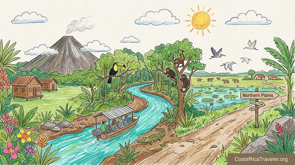
Resetting Expectations: The Northern Plains Are Not Just Arenal
I first based myself in La Fortuna, as most visitors do, at a small cabin-style hotel on the southern side of town near Route 142. From the garden I could see the perfect cone of Arenal Volcano on clear mornings, with the hotel’s gravel driveway still wet from the night’s rain and steam rising off the grass. It felt like the iconic Northern Plains experience I had seen in brochures, and it would have been easy to spend the entire trip between hot springs, zip-lines and waterfall hikes without ever questioning whether there was more.
The turning point came on my second day, when clouds swallowed Arenal by 9 a.m. and never let go. I spent that afternoon talking with the hotel owner about where locals from San Carlos actually travel when they have a few days off. She mentioned Río Celeste, Caño Negro, Sarapiquí and the dairy country north of Ciudad Quesada almost in the same breath, and I realized the “Arenal equals Northern Plains” idea is mostly a tourism simplification. The official tourism materials for the Llanuras del Norte region talk about a mix of volcanoes, wetlands, rivers, caves, waterfalls and rural communities, and those pieces sit much farther apart than they look on a map.
Over the following days, I drove almost every stretch on my own, in a compact SUV rented from San José, and filled in the gaps with shuttles for longer loops. I followed Route 142 around Arenal’s skirt, switched to Route 35 at Muelle de San Carlos and then out along Route 4, the North Atlantic Corridor, which stitches together Sarapiquí and the dairy town of La Fortuna de San Carlos with the northern borderlands. Those roads, sometimes smooth and wide, sometimes patched and rutted after tropical downpours, are the thread that connects very different landscapes. The constant was the humidity, the kind that fogs the windshield if you turn the air conditioning too high and leaves clothes perpetually just shy of dry.
By the end of the trip, I understood that treating the Northern Plains as only “Arenal” is not just inaccurate, it leads to real missed experiences and some wasted hours behind the wheel. My biggest surprises came far from the famous volcano, and I would now plan any Northern Plains itinerary very differently.
La Fortuna & Arenal: Volcanic Mornings, Cloudy Afternoons
In La Fortuna I stayed three nights in a cluster of wooden cabins set back from the road, a few minutes’ drive west of town. The property had a direct volcano view from the shared lawn, but that view turned out to be a fleeting privilege. On my first morning, I woke at 5:30 a.m. to the chatter of great kiskadees and opened the curtains to a clear Arenal, its lava-scarred flanks catching the first light. By 8:30 a.m., clouds had formed a collar around the summit. By late morning the entire cone was hidden and stayed that way under a grey lid of cloud for the rest of the day. That pattern repeated itself daily, a reminder to schedule volcano viewpoints and national park walks early.
Getting to Arenal Volcano National Park from La Fortuna took me about 25 minutes along Route 142 and then the side road that leads to the park entrance. The asphalt was in decent condition, with some potholes near the park, and it was easy to self-drive in a standard SUV. At the park gate I paid the non-resident entrance fee in person with a card and drove on to the main parking area. From there, the trails are mostly old lava flows and secondary forest. The humidity under the trees was thick enough that my shirt was soaked within half an hour, even though light rain never became more than a mist.
Wildlife here was audible more than visible: distant howler monkeys, the piercing call of toucans, and leafcutter ants carrying their bright green loads along the trail. I glimpsed a coati crossing the old lava field just before the official mirador, where the volcano finally emerged between curtains of cloud. It was never postcard-perfect blue, but I appreciated the drama of seeing the cone appear and disappear. In contrast, the La Fortuna Waterfall, a short drive from town on a well-signed paved road, felt more crowded but more predictable. I descended the long concrete staircase to the base, my legs protesting in the heat, and watched people position themselves on slick rocks for photos while cool spray finally cut the humidity.
La Fortuna itself feels like a frontier service town turned tourism hub, with hardware stores and pharmacies sharing the main strip with tour desks and hot spring day-pass signs. I ate casados in simple sodas just off the central park, where plates of rice, beans, plantains and grilled tilapia cost less than the cocktails at upscale hot springs. Evenings were wrapped in light rain, the streets shining with reflections of bus headlights, and the air smelling of wet asphalt and barbecued chicken. It is a convenient base for the volcano and surrounding adventures, but staying only here gives a limited sense of what the Northern Plains are.
North to Caño Negro: Wetlands, Long Roads and Birdsong
Leaving La Fortuna for Caño Negro, I underestimated the drive. I set out after breakfast, taking Route 142 back toward El Tanque and then northeast on Route 35 through the flatlands of San Carlos, before turning onto the more rural road toward Los Chiles and finally the tiny village of Caño Negro. The pavement was mostly good, but there were stretches where recent rains had opened potholes, and heavy trucks kicked spray up from standing water that lingered in roadside ditches. What looked like a simple two and a half hour drive on the map slowly stretched toward three and a half, especially once I stopped at roadside fruit stands and a simple soda in Los Chiles for gallo pinto and coffee.
Caño Negro itself feels like a remote outpost at the end of the road, a cluster of homes, small guesthouses and docks at the edge of the Caño Negro Wildlife Refuge. There are no public visitor centers inside the refuge and you experience it almost entirely by boat, booking with local operators who run from the village and from Los Chiles. I chose a small wildlife-focused company near the main dock and joined a morning tour along the Río Frío. The covered boat was basic but comfortable, with plastic seats, a small cooler of bottled water and life jackets stacked at the back.
Once we left the dock, the pace of the trip shifted completely. The Río Frío is slow and tea-brown, with overhanging trees that lean in as if to listen. In the first hour we saw capped herons, jacanas tiptoeing on floating vegetation, and a line of green iguanas sunning on a fallen branch. A small American crocodile slid off the mudbank at the boat’s engine noise, and our guide pointed out basilisks frozen in their claim to the nickname “Jesus Christ lizards.” The humidity was intense but softened by the breeze off the water, and intermittent light rain never felt like a problem under the metal roof of the boat.
This was where the Northern Plains felt most like a different country from La Fortuna. There were no volcano views, no zip-line cables humming above, only flat horizon and wetland. Lunch after the tour was included at a small restaurant in Los Chiles, where a traditional casado with fried fish and a fresh fruit drink helped bridge the long drive back. In hindsight, trying to visit Caño Negro as a rushed day trip from La Fortuna would have meant six or seven hours on the road for a few quiet hours on the river. Staying at least one night in or near Caño Negro allowed me to be on the water early, when birds are more active and the sun is less punishing. I would gladly have added a second night here and cut one from La Fortuna.
Río Celeste & Tenorio: Turquoise Water and Strict Rules
From Caño Negro, I drove southwest toward Bijagua and Tenorio Volcano National Park to see the famous Río Celeste. The route wound through agricultural land and small towns, then climbed gently toward the foothills. Rain clouds clung to the higher ridges and the air cooled noticeably as I gained elevation. I based myself for two nights in a family-run lodge outside Bijagua, where small cabins sat among gardens of heliconias and hummingbirds worked their rounds from flower to flower. Even without entering the national park, this area felt different from La Fortuna: quieter, cooler and more rural.
Visiting Río Celeste itself required more planning than any other stop in the Northern Plains. Tenorio Volcano National Park currently opens to visitors from 8 a.m. to 2 p.m., with closing at 4 p.m., and there is a daily cap on the number of people allowed on the trail at any one time. Tickets for non-residents must be bought online through the SINAC system in advance, and they are no longer sold in person at the gate. On the day I went, I arrived at the entrance a little before 8 a.m., parked in one of the private lots just outside the gate, and showed my digital ticket to the staff before stepping onto the “Misterios del Tenorio” trail.
The trail is about 3 kilometers each way, an out-and-back through humid forest to the waterfall, the blue lagoon, bubbling hot springs and finally El Teñidero, where two clear rivers meet and suddenly turn cobalt. Even in the dry season, the path was muddy in places, and the long concrete staircase down to the waterfall demanded slow, careful steps. Mist hung in the trees and condensed on my arms as sweat. At the waterfall platform, the Río Celeste plunged into a pool of almost unreal blue, made softer by overcast light that kept the color from blowing out in photos. Park rules are strict: no swimming anywhere inside the national park, no drones, and visitors must stay on the trail.
What surprised me most was how controlled and calm the experience felt compared with internet photos that suggest crowds. By arriving for the first time slot, I shared the waterfall platform with only a handful of people. As I hiked back, I passed increasingly large groups heading toward it, many already breathing heavily on the staircase in the rising heat. Outside the park, a short drive away on a rougher road, there are riverside spots where private landowners offer access to downstream sections of Río Celeste for swimming, but the water is more muted in color and the atmosphere more festive.
In hindsight, I made one key mistake with Río Celeste: trying to combine the national park hike with a long driving day. Friends I met at the lodge drove from Liberia and tried to add a hanging bridges walk in the same day. They looked exhausted at dinner, having underestimated both the trail and the delays that tropical weather can add to any schedule. If I could redo this part of the trip, I would still spend two nights near Bijagua but leave the day of the hike completely open, with no long drives before or after. Río Celeste deserves a slow morning on its own, not a rushed photo stop between destinations.
Sarapiquí & San Carlos: Rivers, Farms and Everyday Life
From Bijagua and Río Celeste, I turned east, eventually joining Route 4, the North Atlantic Corridor, which runs between Muelle de San Carlos and the Sarapiquí area before continuing toward the Caribbean side. This road is a key artery for trucks and local traffic, and while the surface was mostly paved and in fair condition, it felt less forgiving than the tourist-focused approaches to La Fortuna. There are stretches where the shoulders narrow, villages appear suddenly, and cyclists share the edge of the road. I drove this section in steady rain, windshield wipers swiping at a near-constant medium speed, and I was glad to have a vehicle with decent clearance and good brakes.
I based myself for two nights near Puerto Viejo de Sarapiquí, at a simple riverfront lodge set off a gravel spur from Route 4. Here, the soundscape shifted again. Instead of the distant rumble of Arenal or the bird calls of Caño Negro, the dominant noise was water: the slow rush of the Sarapiquí River and the quick afternoon downpours that hammered the metal roof of my cabin and then stopped as fast as they had begun. The air felt more tropical and heavier than around Tenorio, and mosquitos emerged in force at dusk, making long sleeves and repellent part of the evening routine.
Sarapiquí is known for rafting, and I joined a half-day trip on the class II and III section of the Sarapiquí River. The operator picked me up in a small shuttle from the lodge, joining a mix of local families and international visitors. We bounced along a potholed gravel road to the put-in, where the guides gave a safety briefing under a tin-roofed shelter while warm rain fell. On the river, the rapids were fun but not terrifying, with long flat pools in between where we spotted kingfishers, anhingas and a sloth curled high in a cecropia tree. The water was a rich brown after recent rain, cooler than the air, and the humidity wrapped everything in a damp film.
Between river days, I spent time in the small towns of the San Carlos plains, including Muelle and La Tigra. These are not destinations that appear on most itineraries, but they gave context to the tourist centers. In Muelle, I stopped at a roadside soda that looked straight out of a long-haul driver’s guide, all fluorescent lights and plastic chairs. A simple plate of arroz con pollo and salad cost less than a smoothie at a La Fortuna café, and the conversations around me revolved around cattle prices, school schedules and the condition of Route 4, not adventure tours. In La Tigra, I visited a small private reserve with short forest trails and a basic canopy tower, where the view looked out over patchwork farmland instead of perfectly framed volcanoes.
If I had known how different Sarapiquí and the wider San Carlos area would feel from Arenal, I would have carved out at least one more night here. The region’s rivers and farmland give a sense of how people actually live in the Northern Plains, beyond the strip of hotels that frame the classic volcano shot. It also breaks up what can otherwise become long, tiring driving days.
Weather, Roads and The Reality of Getting Around
One of the biggest surprises of my Northern Plains journey was how much time I spent simply moving between places, and how much the weather controlled that movement. In theory, distances look modest. La Fortuna to Caño Negro, La Fortuna to Río Celeste, Río Celeste to Sarapiquí: each one sits in the one and a half to three and a half hour range on paper. In practice, tropical downpours, slow trucks, roadworks and narrow bridges stretch everything out. I drove most legs in a compact SUV with automatic transmission and moderate clearance, which I was grateful for whenever a pothole appeared suddenly under a sheen of rainwater.
Rain itself varied more than I expected. Around Arenal, showers were frequent but often light, especially in the early afternoon, leaving roads damp and steaming but rarely flooded. In Caño Negro, a nighttime thunderstorm turned the village streets into shallow channels that reflected every porch light, though the main access road remained passable the next morning. Near Tenorio and Río Celeste, cloud and drizzle wrapped the hills in a way that made the forest feel mysterious but kept the trails consistently muddy. In Sarapiquí, two evenings brought short, violent storms that sent sheets of water cascading off tin roofs and briefly over the lodge’s gravel access road before draining away.
Shuttles helped on the longest legs. Between La Fortuna and Rincón de la Vieja, on a separate loop, I had previously used a shared shuttle that followed parts of Route 142 and Route 1. That experience, sitting higher above the road and watching the driver anticipate every slow truck and blind corner, informed my decision to self-drive the Northern Plains loop but with realistic expectations. When booking rafting in Sarapiquí and the Caño Negro boat trip, hotel staff arranged door-to-dock transport in small vans, which removed the stress of navigating unmarked turnoffs in heavy rain.
If I were to advise someone planning a similar route, I would say this: plan around the humidity as much as the driving distances. Morning activities are more comfortable and offer better visibility for volcanoes and wildlife. Leave gaps between major moves, and resist the temptation to chain together multiple high-effort experiences on the same day. I made the mistake of driving a long leg toward Bijagua and then immediately hiking a steep local trail that afternoon, and I arrived at the cabin that evening with clothes that felt permanently damp and legs on the edge of cramping. The Northern Plains reward slow travel far more than rushed checklists.
What I Would Do Differently Next Time
Looking back, my biggest planning error was allocating too many nights to La Fortuna and too few to the less famous corners of the Northern Plains. Four nights around Arenal would be ideal only for travelers who are deeply invested in adventure tours and hot springs. For a mix of nature and regional variety, I would now choose two or three nights in La Fortuna, two nights near Bijagua for Río Celeste and Tenorio, two nights in the Caño Negro area, and two in or near Sarapiquí. That rhythm would cut down on backtracking and give each landscape room to breathe.
I would also be more strategic about when to drive which roads. Route 142 around Arenal is straightforward, but sections near the dam and beyond can become foggy and slick in the late afternoon. The approach to Caño Negro benefits from daylight, since livestock occasionally graze near the roadside and unmarked speed bumps appear at the edges of villages. Route 4 near Sarapiquí is heavily used by trucks, and I felt safest tackling it mid-morning, after the early rush but before the afternoon storms that can reduce visibility.
In terms of specific experiences, I would give Caño Negro and Sarapiquí more time and accept that I might see less of Arenal’s summit as a trade-off. The wetlands offered some of the best wildlife viewing of the trip, and the quiet secondary trails near Sarapiquí provided a sense of discovery that is harder to find on the well-trodden paths of Arenal National Park. I would also build in at least one “lazy day” somewhere in the middle of the itinerary, ideally at a lodge with forest trails and a river or small pool, where I could let clothes finally dry and recharge between driving days.
Finally, I would remind myself from the start that the Northern Plains are defined as much by their rural communities as by their headline landscapes. The region’s official descriptions talk about volcanoes, wetlands, rivers, caves and waterfalls, but the stories that stuck with me came from dairy farmers near San Carlos talking about pasture rotation, a boat captain in Caño Negro pointing out how water levels have shifted over the years, and a lodge owner in Sarapiquí explaining how Route 4 changed the rhythm of deliveries and school commutes. Knowing that, I would leave more time for unscripted stops, simple meals in sodas and quiet evenings listening to rain on a tin roof.
The Takeaway
Travel in Costa Rica’s Northern Plains often starts with a photo of Arenal Volcano and a promise of hot springs. That image is real, but it is only part of the story. Once you drive beyond La Fortuna, the region unfolds into a patchwork of flooded wetlands, turquoise rivers, working farms and slow brown waterways that carry more herons than rafts. Each area feels distinct in weather, rhythm and even scent, from the sulfur-tinged air near Río Celeste to the earthy sweetness of Sarapiquí’s riverbanks at dusk.
What surprised me most was how much the journey changed when I stopped treating “Arenal” as shorthand for the entire Northern Plains. By staying in Caño Negro, I woke to the sound of boats leaving for dawn birding trips instead of tour buses collecting zip-line clients. Near Bijagua, I watched clouds shred themselves on Tenorio’s slopes and saw the Río Celeste turn blue in real time, under strict park rules that keep the experience from being loved to death. In Sarapiquí and San Carlos, I shared counters with truck drivers and farmers who rarely visit La Fortuna unless they need supplies.
If you are planning your own trip, my strongest encouragement is to slow down and spread out. Give yourself at least a week, ideally ten days, and distribute your nights among different corners of the region instead of stacking them all around the volcano. Check current park hours and ticket systems before you go, especially for Tenorio and Río Celeste, and consider when rain and afternoon clouds will shape your experience. Accept that some days will be defined as much by wet clothes and muddy boots as by wildlife sightings or views.
The Northern Plains will reward that patience. They are not a single destination but a constellation of places linked by rivers and roads, where volcano silhouettes share the horizon with cattle pastures and flooded lagoons. Once you move beyond La Fortuna, you may find, as I did, that your favorite memories of the region have nothing to do with seeing Arenal’s summit clearly at all.
FAQ
Q1. Is it realistic to visit Arenal, Río Celeste, Caño Negro and Sarapiquí in one week?
Yes, it is possible in about seven to ten days, but you need to limit backtracking. A loop with two or three nights in La Fortuna, two in the Río Celeste area, two in Caño Negro and one or two in Sarapiquí keeps driving days manageable.
Q2. Do I need a 4x4 to drive around the Northern Plains?
A high-clearance vehicle is helpful but a full 4x4 is not always essential in normal conditions. Main roads like Routes 142, 35 and 4 are paved, though potholes, narrow shoulders and heavy rain can slow travel, and smaller access roads to lodges and trailheads may be gravel.
Q3. How early should I visit Arenal Volcano National Park or La Fortuna Waterfall for good views?
Clearer skies are most common in the early morning. Arriving near opening time gives you the best chance to see Arenal’s summit before clouds build, and it makes hiking cooler and less crowded.
Q4. How do I buy tickets for Tenorio Volcano National Park and Río Celeste?
Tickets for non-residents must be purchased online in advance through the official SINAC system, and the park currently admits visitors from 8 a.m. to 2 p.m. with closing at 4 p.m. Physical ticket sales at the gate are no longer available, so you should secure a date and time before arriving.
Q5. Can I swim in Río Celeste inside Tenorio Volcano National Park?
No, swimming is prohibited inside the national park to protect the river and for safety reasons. Some private properties downstream offer paid access to sections of the river where swimming is allowed, but the water color is usually softer than at the main waterfall and viewpoints.
Q6. Is Caño Negro better as a day trip from La Fortuna or as an overnight stay?
It can be done as a long day trip, but staying at least one night in or near Caño Negro makes for a more relaxed experience. Overnighting allows you to take early morning boat tours when wildlife is more active and avoids spending most of the day in transit.
Q7. What kind of wildlife can I expect to see in Caño Negro and Sarapiquí?
In Caño Negro, boat tours along the Río Frío often reveal herons, kingfishers, caimans, iguanas, monkeys and many bird species. Around Sarapiquí’s rivers and forests, you may see toucans, sloths, basilisks and a variety of tropical birds, especially on guided walks or rafting trips.
Q8. How intense is the hike to the Río Celeste waterfall?
The main trail is roughly 3 kilometers each way with some muddy sections and a long, steep staircase down to the waterfall viewpoint. Most reasonably fit travelers can complete it in about three hours round-trip, but high humidity and heat make it feel more strenuous than the distance suggests.
Q9. Is rafting in Sarapiquí suitable for beginners and families?
Yes, many operators run class II and III sections of the Sarapiquí River that are appropriate for adventurous beginners and families. Trips include safety briefings, guides and all equipment, and you can choose calmer or more challenging stretches depending on comfort level.
Q10. When is the best time of year to visit the Northern Plains of Costa Rica?
Conditions vary, but the drier months from about December to April tend to bring more sun and slightly less rain, while remaining quite humid. The wetter months can offer lusher landscapes and excellent wildlife viewing, but you should be prepared for heavier showers, muddier trails and occasional travel delays.