


Puntarenas is one of Costa Rica’s most confusing destinations to research. The name refers to a city, a huge province, and several different tourism regions that are often bundled together in guidebooks. For a first visit, that can make planning your route, ferries, and beach time harder than it needs to be. This guide breaks Puntarenas into clear, traveler-friendly areas and shows you how to realistically combine the Gulf of Nicoya, Monteverde’s cloud forests, and the Nicoya Peninsula beach towns of Paquera, Tambor, Montezuma, Cabuya, Cabo Blanco, Santa Teresa and Mal País.
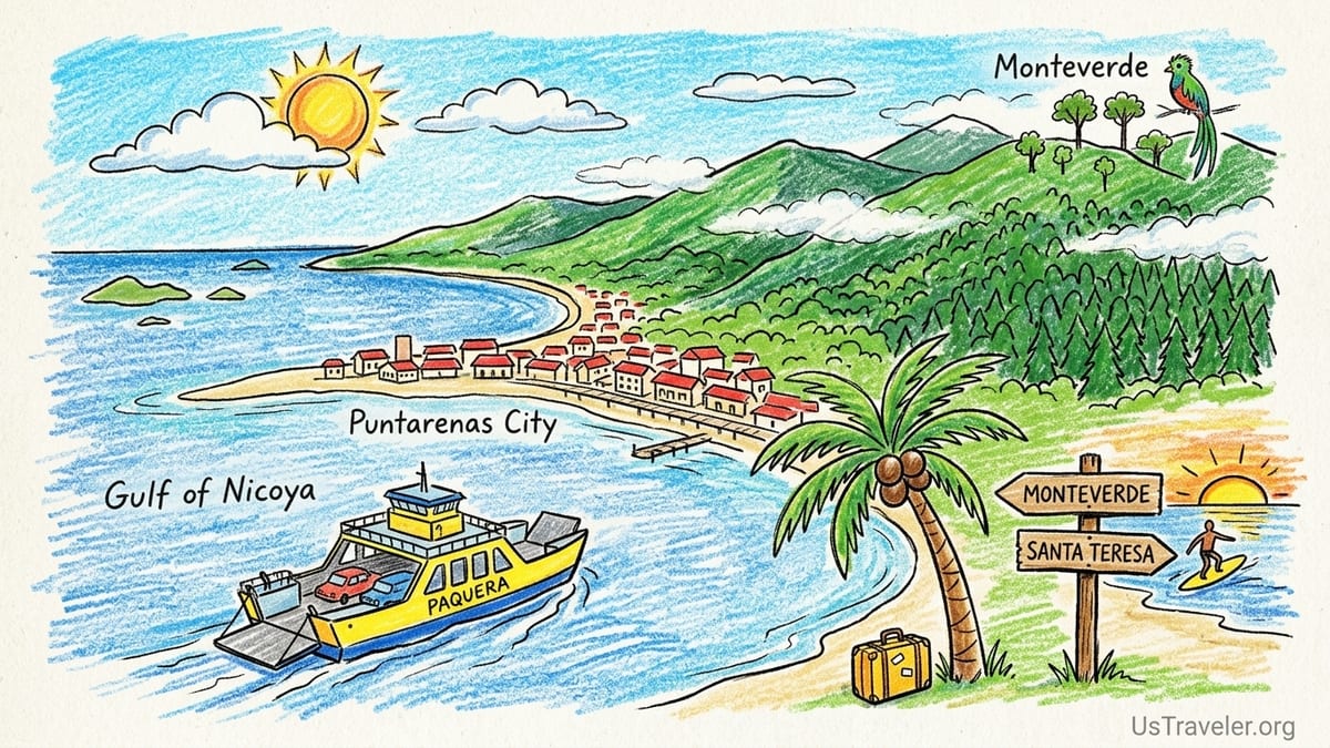
Understanding Puntarenas: City, Province and Visitor Regions
When locals say “Puntarenas,” they may mean three different things. First is Puntarenas city, a narrow sand spit that stretches into the Gulf of Nicoya. It is a working port, regional hub and the departure point for the vehicle ferries that cross the gulf. This is where you board the ferries to Paquera and Playa Naranjo, stroll the Paseo de los Turistas seaside promenade, and catch most long-distance buses serving the gulf and Nicoya Peninsula.
Second is Puntarenas Province, an administrative region that covers a huge swath of Costa Rica’s Pacific coast, from the Gulf of Nicoya all the way down past Jacó and Manuel Antonio to the Osa Peninsula near Panama. For trip planning, this definition is too broad to be useful. Guides sometimes lump Jacó, Manuel Antonio and even Osa into “Puntarenas,” but each of those works better as its own destination. This article keeps the focus on the practical visitor region around the Gulf of Nicoya, Monteverde and the southern Nicoya Peninsula.
Third is what tourism offices and local operators describe as the Puntarenas travel region. In practice, this means Puntarenas city and the Gulf of Nicoya islands, the cloud forests around Monteverde and Santa Elena in the interior highlands, and the southern tip of the Nicoya Peninsula, including Paquera, Tambor, Montezuma, Cabuya, Cabo Blanco, Santa Teresa and Mal País. These areas are commonly combined on one itinerary because they are linked by ferries and mountain roads and share a relaxed, nature-focused character.
For first-time visitors, it helps to think in five linked zones. Puntarenas city and the Gulf of Nicoya form your gateway. Monteverde offers cool cloud forest and wildlife. Paquera and Tambor are your soft-landing beach and ferry ports. Montezuma, Cabuya and Cabo Blanco mix waterfalls, low-key beaches and protected forest. Santa Teresa and Mal País are the surf and sunset stretch. Jacó, Manuel Antonio and the Osa Peninsula officially sit inside Puntarenas Province, but they are best treated as separate trips and are not covered here.
Puntarenas City & Gulf of Nicoya: Ferries, Islands and Simple Beaches
Puntarenas city is often a transit stop, but it rewards a short break. The long Paseo de los Turistas promenade lines the inner shore of the sand spit with casual restaurants, ice cream stands and small hotels. You will see local families renting umbrellas on the beach, kids swimming in the relatively calm inner gulf and vendors selling churchills, an over-the-top shaved ice with syrup, condensed milk and ice cream. The water here is murkier than on ocean beaches, but sunsets over the gulf can be spectacular and the atmosphere feels authentically Costa Rican.
The city’s main importance for travelers is its role as a transport hub. At the western end of the sand spit sits the ferry terminal for the Puntarenas to Paquera route, commonly known as the Tambor ferry because it is the most direct way to reach Tambor and the southern Nicoya Peninsula. Vehicle tickets for a light passenger car cost around the equivalent of just over twenty US dollars one way, with passengers paying an additional per-person fee. It is wise to buy or reserve tickets in advance in peak months such as late December and early January and to arrive at least one hour before departure to secure a place in line.
The Gulf of Nicoya itself is dotted with small, hilly islands, many covered in dry tropical forest. From Puntarenas you can book full-day boat tours that combine island-hopping with snorkel stops, beach time and simple lunches. A typical example is a Tortuga Island excursion, which usually includes a one to one-and-a-half hour boat ride across the gulf, a few hours of swimming and snorkeling off a white-sand beach, and a grilled fish or chicken lunch under palm trees. Prices often sit in the range of a mid-tier full-day tour elsewhere in Costa Rica and include basic gear and park or landing fees.
If you want to break up a journey, budget hotels and guesthouses cluster near the promenade and ferry terminal. Many cater to domestic travelers with family rooms, secure parking and simple seafood restaurants. A realistic pattern for a first-timer might be to arrive from San José by bus or rental car in the late afternoon, check into a waterfront hotel, enjoy a relaxed evening stroll along the Paseo de los Turistas and catch a morning ferry to Paquera for onward travel to Tambor, Montezuma or Santa Teresa.
Monteverde Cloud Forest: Cool Air and Hanging Bridges
Monteverde sits inland and uphill from Puntarenas, on the spine of the Tilarán mountain range. After humid hours on the coast, arriving here feels like stepping into a different climate. The road from the Pacific side climbs quickly to elevations above 1,400 meters, where persistent clouds drift through moss-covered trees and temperatures can drop into the low teens Celsius at night. Most visitors base themselves in or around the small towns of Santa Elena and Monteverde, which function as one compact tourism hub with lodges, hostels, cafes and tour offices.
The Monteverde Cloud Forest Biological Reserve, Santa Elena Cloud Forest Reserve and the Curi-Cancha Reserve next door anchor most nature experiences here. Trails weave through dense, epiphyte-covered forest, with viewpoints out over the Continental Divide on clear days. Hanging bridge parks in the area allow you to walk at canopy level, while dedicated birdwatching tours head out early in search of species such as the resplendent quetzal. Many reserves now operate with timed entries or recommend advance reservations, especially in the dry-season months of December through April and again around Easter week.
Monteverde’s tourism infrastructure is well developed for a mountain village. You will find everything from simple cabinas at modest nightly rates to boutique eco-lodges that can cost several hundred dollars per night, often including guided walks. A typical mid-range hotel might offer breakfast, a free shuttle into Santa Elena and the ability to book a cloud forest tour, night walk and canopy zip line directly at reception. Tour prices are in line with other popular Costa Rican destinations, and many operators will collect you at your accommodation and include entrance fees in a packaged rate.
Reaching Monteverde from Puntarenas or the Nicoya Peninsula requires some planning. From Puntarenas city, most visitors drive or take a shuttle north toward the Pan-American Highway before turning inland. The total journey time by car is usually around three to four hours depending on road conditions and traffic. From Santa Teresa and Montezuma, you can combine the Paquera ferry with a shuttle via the bridge over the Tempisque River, avoiding the long drive back through Puntarenas. Be prepared for winding roads and slow travel times, and avoid planning tight same-day connections with international flights.
Paquera & Tambor: Ferry Gateways and Gentle Bays
Paquera is the Nicoya Peninsula’s main ferry port for travelers arriving from Puntarenas across the Gulf of Nicoya. The town itself is inland from the shoreline, with basic services such as ATMs, supermarkets and local eateries. Just outside town, small bays and beaches line the gulf, some used as departure points for tours. Operators here offer boat trips into the surrounding waters to look for bioluminescence on dark nights, visit nearby islands or combine coastal mangrove exploration with snorkeling in the gulf.
From the Paquera dock, it is a short drive along the paved main road to reach Tambor. Tambor sits on a broad, sheltered bay that feels calmer than the open Pacific beaches further west. The bay’s brown-sand beach curves gently around shallow water, making it a practical choice for families with small children or for travelers wanting to swim without strong surf. Resorts and mid-range hotels sit back from the sand among gardens and palms. Staying a night or two in Tambor can be a good way to decompress immediately after the ferry crossing before tackling rougher roads toward Montezuma or Santa Teresa.
Paquera and Tambor also sit within easy reach of several protected areas. The Curú Wildlife Refuge lies between Paquera and Tambor and offers day visits for hiking and wildlife watching. Some Tortuga Island tours actually depart from Curú’s beaches, cutting down the open-water crossing time. To the northwest, quieter beaches such as Pochote and Órganos offer a glimpse of local coastal life, with small fish restaurants and low-key cabinas that tend to attract domestic visitors more than international tourists.
In practical terms, Paquera and Tambor form the hinge between the mainland and the outer tip of the Nicoya Peninsula. Many rental car itineraries use them as a first or last base on the peninsula. For example, a realistic route could have you landing in San José, taking a morning bus to Puntarenas, crossing on the midday ferry to Paquera, then transferring to a hotel in Tambor for a gentle first night in Costa Rica before continuing to Montezuma or Santa Teresa the next day.
Montezuma, Cabuya & Cabo Blanco: Waterfalls and Wild Coast
Montezuma sits on the southeastern edge of the Nicoya Peninsula, a compact village backed by hills and facing a small bay. The main street is lined with cafes, simple guesthouses, yoga studios and tour kiosks promoting boat trips, surf lessons at nearby beaches and horseback riding. Montezuma’s beach is a mix of sand and rock, better suited to strolling and tide-pooling than long swims at low tide, but it turns golden and inviting when the light is right. The town’s bohemian feel and walkability make it attractive to travelers who prefer to stay car-free.
One of the area’s signature attractions is the Montezuma waterfall series. From the edge of town, a riverside path leads inland to a set of cascades and pools. The lower fall is relatively easy to reach, although footing can be slippery and water levels vary by season. Some visitors continue to higher pools above via steeper trails or guided routes. In the dry months, local guides often combine waterfall visits with canopy tours or horseback rides. Entry may involve a modest fee, and it is worth wearing sturdy shoes rather than flip-flops, especially if you plan to climb to the upper pools.
South of Montezuma, the road follows the coast to Cabuya, a quieter fishing village where daily life feels slower. Just offshore lies a small island that becomes accessible on foot at low tide, allowing visitors to walk across a rocky causeway. Cabuya is also the northern gateway to the Cabo Blanco Absolute Natural Reserve, one of Costa Rica’s earliest protected areas. Trails here lead through dense forest to a remote beach on the Pacific side of the peninsula. The reserve has limited opening days and hours and caps the number of daily visitors, so it is important to check current schedules locally and plan your hike for a morning start to avoid midday heat.
Accommodation options in Montezuma and Cabuya range from budget hostels and simple cabinas to a handful of boutique hotels on forested hillsides. Nightly rates are often lower here than in Santa Teresa, reflecting the more low-key profile of the area. Many travelers choose to spend three or four nights, using the villages as bases for waterfall hikes, day trips to Cabo Blanco, and snorkel or fishing tours that depart from nearby coves. The road network centers on the junction town of Cóbano, so most trips in or out of Montezuma involve at least a short ride on the sometimes dusty road between Cóbano and Paquera or Cóbano and Santa Teresa.
Santa Teresa & Mal País: Surf Towns at the End of the Road
Santa Teresa and neighboring Mal País occupy the southwestern tip of the Nicoya Peninsula, facing the open Pacific. The main road here runs roughly parallel to the beach, lined with surf shops, small hotels, hostels, international cafes and yoga studios. A first impression is of a long, spread-out beach community rather than a single village center. Playa Carmen, Playa Santa Teresa and Playa Hermosa form a near-continuous stretch of sand, with different sections appealing to different types of surfers and travelers.
This coast is famous for its consistent beach breaks. Playa Carmen, near the main crossroads, is popular with surf schools and beginner to intermediate surfers when swell is moderate. Playa Santa Teresa and breaks further north attract more experienced surfers, especially on larger swells. Surf lessons are widely available, with reputable schools typically offering two-hour beginner sessions including board and rash guard. Dedicated surf camps bundle accommodation, daily lessons and video analysis into week-long packages that can cost roughly what you would expect for a specialized retreat in a remote surf town with growing global popularity.
The vibe in Santa Teresa and Mal País sits at the intersection of surf town and wellness hub. Yoga classes, pilates sessions and functional training gyms are easy to find, and many hotels advertise sunrise or sunset yoga on shaded decks. Dining options are broad, from simple sodas serving casados, the typical plate of rice, beans, salad and a choice of meat or fish, to high-end restaurants offering tasting menus that change with seasonal produce. Prices in this part of the peninsula can feel higher than in Montezuma or Tambor, reflecting its popularity and remoteness.
Road conditions deserve attention when including Santa Teresa and Mal País in an itinerary. The main road into town from Cóbano has seen progressive paving, but stretches can still be potholed or dusty, especially in the dry season. Many visitors recommend a higher-clearance vehicle, and a four-wheel-drive can be helpful if you plan side trips down lesser-used roads or are visiting during the wettest months when rivulets cross low points. Without a car, you can rely on local buses, shuttle services and tuk-tuks to move between beaches, but distances are long enough that walking everywhere under a midday sun quickly becomes tiring.
Transport, Ferries and Combining Regions in One Trip
Because these Puntarenas regions are tied together by a gulf and mountain range, realistic planning depends on understanding ferries and road travel times. The Puntarenas to Paquera ferry remains the key link between the mainland and the southern Nicoya Peninsula. Crossings typically take around seventy to eighty minutes and run multiple times per day, with more frequent services in busy periods. Vehicle spaces can sell out during local holiday weeks, so booking in advance and arriving early are standard local tips. foot passengers usually have an easier time securing last-minute spots, but should still allow time for ticket purchase and boarding.
From San José, you can either drive or take a direct bus to Puntarenas, then connect with the ferry. Buses run on fixed schedules from the capital to the Puntarenas dock, with journeys often taking two to three hours depending on traffic through the central valley. On arrival in Paquera, another bus line continues through Tambor and Cóbano, with branches to Montezuma and Santa Teresa. Travelers carrying surfboards report that most intercity buses in Costa Rica have underfloor luggage compartments capable of handling boards, but they should expect to pay a small fee and take responsibility for padding and labeling their equipment.
A compact but satisfying first-time itinerary might start with one night in Puntarenas city to recover from the flight, then continue with the ferry to Paquera and a couple of nights in Tambor for relaxed bay swimming and a visit to Curú Wildlife Refuge or a Tortuga Island tour. From there, you could move on to Montezuma for waterfalls and a day in Cabo Blanco, then continue by road to Santa Teresa or Mal País for three or four days of surfing or beach walking. To round out the trip, travel back to Paquera, cross to Puntarenas and drive or take a shuttle up to Monteverde for cloud forest trails and cooler temperatures before returning to San José.
If you prefer to minimize backtracking, another pattern is to start in Monteverde, then drive down to the Gulf of Nicoya area, loop through Puntarenas city, take the ferry to Paquera, and finish with time in Montezuma and Santa Teresa before exiting via a domestic flight from Tambor to San José. Domestic airlines operate small planes on this route, and luggage limits can be strict, so travelers carrying surfboards or heavy camera gear should check policies before committing. In all cases, it pays to allow buffer time on either side of ferry crossings and mountain drives, especially in the green season when heavy afternoon rains can slow travel.
The Takeaway
Understanding what “Puntarenas” actually means is the key to planning a logical route. Puntarenas city and the Gulf of Nicoya offer ferries, island tours and a glimpse of everyday life on the Pacific. Monteverde brings cool cloud forests, hanging bridges and birdlife. Paquera and Tambor act as practical gateways and soft-landing beaches. Montezuma, Cabuya and Cabo Blanco provide waterfalls, wild coastline and some of the country’s oldest protected forest. Santa Teresa and Mal País deliver reliable surf, long beaches and a cosmopolitan but still rustic surf-town atmosphere.
These regions connect naturally by ferry and road, but distances and conditions make it important to travel slowly. A well-paced itinerary spends at least two or three nights in each major base and avoids trying to cram in far-flung destinations like Jacó, Manuel Antonio or the Osa Peninsula in the same short trip. By focusing on this coherent cluster of Puntarenas regions, first-time visitors can experience a representative slice of Costa Rica’s Pacific coast, from warm, sheltered gulf waters to misty cloud forests and world-class surf, without spending most of their time in transit.
FAQ
Q1. What is the difference between Puntarenas city, Puntarenas Province and the Puntarenas travel region?
Puntarenas city is the port town on a sand spit in the Gulf of Nicoya. Puntarenas Province is a large administrative area that includes much of Costa Rica’s Pacific coast. The Puntarenas travel region, as used in this guide, refers specifically to the city and gulf, Monteverde’s cloud forests and the southern Nicoya Peninsula around Paquera, Tambor, Montezuma, Cabuya, Cabo Blanco, Santa Teresa and Mal País.
Q2. How long is the ferry from Puntarenas to Paquera, and should I book in advance?
The Puntarenas to Paquera ferry crossing usually takes a little over an hour. In quieter months, foot passengers can often buy tickets on the day, but vehicles should be reserved in advance, especially around Christmas, New Year, Easter week and local holiday weekends, when sailings can sell out.
Q3. Do I need a 4x4 to visit Montezuma, Santa Teresa and Mal País?
You can reach Montezuma and Santa Teresa in a regular car when conditions are dry, but many travelers prefer a higher-clearance vehicle for comfort on potholes and occasional rough stretches. A four-wheel-drive becomes more useful in heavy rain, on side roads or if you plan to explore lesser-known beaches that involve unpaved tracks and small water crossings.
Q4. Is Monteverde worth visiting if I am already going to the beach in Puntarenas?
Yes. Monteverde offers a completely different ecosystem and climate from the coast. Up in the cloud forest you will find cooler temperatures, hanging bridges, birdwatching and dense, mossy forest, which contrast strongly with the hot, dry beaches of the Nicoya Peninsula. Many first-time visitors say the mix of beach and cloud forest was the highlight of their trip.
Q5. How many days should I spend in Santa Teresa and Mal País for surfing?
If you are a beginner or lower intermediate surfer, plan at least four to five days so you can take a couple of lessons, have rest days and adjust to local conditions. More experienced surfers often stay a week or longer to wait for favorable swells and explore different sections of beach such as Playa Carmen and Playa Hermosa.
Q6. Can I visit Cabo Blanco and Montezuma waterfall in one day?
It is possible but tiring, and most visitors prefer to split them into separate days. Cabo Blanco involves a longer forest hike, often best done in the morning to avoid heat, while Montezuma waterfall demands time and care on rocky paths. Spreading them out allows for safer hiking and time to enjoy swimming or wildlife watching without rushing.
Q7. Is it safe to swim around Puntarenas city and the Gulf of Nicoya beaches?
The inner gulf beaches near Puntarenas city generally have gentler conditions than open Pacific beaches, but water quality can vary and the sand is darker and less postcard-perfect. On the Nicoya Peninsula side, bays like Tambor usually offer calmer, more swimmable water, while ocean-facing beaches closer to Santa Teresa can have stronger waves and currents that require more caution.
Q8. What is the best way to combine Monteverde with the Nicoya Peninsula without too much backtracking?
A practical route is to start in Monteverde, then drive down to the Gulf of Nicoya and continue to Puntarenas for the ferry to Paquera, finishing your trip in Montezuma or Santa Teresa. Alternatively, begin on the peninsula, work your way from Tambor to Santa Teresa and Montezuma, then cross back to Puntarenas and drive up to Monteverde before returning to San José.
Q9. Do I need to join a tour to visit Monteverde cloud forest reserves?
You can visit many Monteverde reserves independently by paying the entrance fee and walking signed trails on your own. However, guided tours offer expert spotting of birds and animals and detailed explanations of the ecosystem. Many visitors choose at least one guided walk, such as a natural history tour in the morning or a night walk, and then explore other trails at their own pace.
Q10. When is the best time of year to visit these Puntarenas regions?
The driest months on the Pacific side generally run from December through April, bringing sunnier days and more reliable road conditions but also higher prices and more visitors. The green season from May to November sees more rain, especially in the afternoons, but can offer lusher landscapes, fewer crowds and lower accommodation rates. Ferry schedules and tours operate year-round, though very intense storms can occasionally disrupt travel.