


I arrived in the South Pacific of Costa Rica already sticky. The little Sansa prop plane from San José bumped down onto the runway at Puerto Jiménez in the late afternoon, the kind of flat, white sunlight that makes the air feel heavier. I had twelve days to work my way along the country’s wild southern coast, splitting my time between the mainland beaches near Uvita, the mangroves and towns around Golfito and Golfo Dulce, and finally the more remote Osa Peninsula and Corcovado. I had imagined constant sun, easy beach driving and a string of barefoot ecolodges a short stroll from the road. What I got instead was early mornings, muddy luggage, boat schedules, surprise rain, howler monkeys as my alarm clock, and a much clearer picture of what traveling through South Pacific Costa Rica actually feels like.
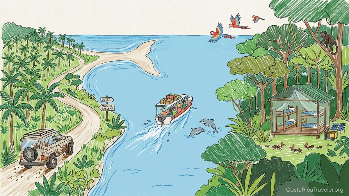
How I Structured the Trip Along the South Pacific
I started on the mainland coast, flying into San José and connecting onto a domestic flight to Puerto Jiménez rather than driving the full eight or nine hours from the capital. From there, I worked in a loose loop: first a shuttle and rented 4x4 up the Costanera Sur highway to Uvita, then down toward Golfito and the edges of Golfo Dulce, then back across the gulf by boat and deeper into the Osa Peninsula for Corcovado. In total I spent twelve days in the region, with three nights based near Uvita, three in the Golfo Dulce area, and six split between Puerto Jiménez and a remote lodge that was only accessible by boat.
This order mattered. The further south and west I went, the more the paved highway gave way to potholes and gravel, and the more my days were governed by tides, boat transfer hours and park reservation rules instead of simple driving times. On the first day I could roll up to Marino Ballena National Park outside Uvita, pay my entry at the gate and walk the sandbar out to the famous “whale tail” tombolo as long as I respected the tides. By the time I reached Corcovado National Park, I needed a registered guide and confirmed permits booked weeks ahead through SINAC’s reservation system or a licensed tour operator, and my days started at 4:30 in the morning.
I overpacked the itinerary. On paper, twelve days sounded generous for the stretch from Uvita down to the Osa Peninsula. In reality, the combination of humidity, rough roads in sections of Route 245 near Puerto Jiménez and the mental load of catching specific boats across Golfo Dulce meant I was moving slower and tiring faster than my plans allowed. If I could redo it, I would shave one base, accept seeing fewer places, and stay longer in the spots that felt both wild and workable as a traveler.
First Impressions: Mainland Coast Around Uvita
The mainland South Pacific around Uvita was my soft landing. The Costanera Sur highway into town is paved and in decent condition, and for the first three days I did not strictly need the 4x4 I had rented out of habit. I based myself in the hills above Uvita, close enough that I could drive ten or fifteen minutes down a steep concrete road to reach the entrance of Marino Ballena National Park, but far enough up that the air in the evenings was marginally cooler. Humidity was still a constant. By eight in the morning, just walking from the car park to the beach left my clothes damp.
In this stretch the South Pacific felt busy but not overwhelmed. Uvita has multiple supermarkets, ATMs and sodas serving casados for the equivalent of 6 to 10 US dollars. I took cash out at the Banco Nacional ATM in town after realizing my mistake at the airport, where I had landed in Puerto Jiménez with barely enough colones to cover a taxi. On the mainland coast most places accepted cards, but smaller tour operators still preferred cash deposits, and paying the Marino Ballena entrance fee at the official ticket booths was easier with local currency. The park itself is open year-round, with different entry hours depending on the sector, and I appreciated that I could simply turn up, buy a ticket at the gate and walk in the same day.
The beaches around Uvita are long and brown-sand, backed by palms and mangroves. Swimming is possible but the Pacific here can have a decent shore break and currents, so I stayed conservative, especially when I was on my own. The heat and humidity were serious enough that my best hours were early. I booked a 6:00 a.m. whale watching tour that left from the Playa Uvita sector during humpback season, and the combination of cooler air, calmer water and the low angle light on the mountain backdrop made it one of the more relaxed outings of the trip. I was back on shore before the sun turned brutal, and by early afternoon I understood why the town slowed down under the weight of the heat and humidity, even in what locals called the “drier” part of the year.
Sliding South: Mangroves, Golfito and Life Around Golfo Dulce
From Uvita I drove the Costanera Sur farther south. The highway remained paved but the character of the trip shifted as I passed palm plantations and quieter stretches of coast. My destination was Golfito and then Golfo Dulce, the large tropical gulf that separates the mainland from the Osa Peninsula. The air here felt even heavier. When I stepped out of the car near Golfito’s waterfront in the early afternoon, my glasses fogged instantly and the soundscape was different: fewer waves, more cicadas, birds and the low chug of small boats moving in and out of the harbor.
I had underestimated how much logistics would start to matter here. Public boats cross between Golfito and Puerto Jiménez on the far side of Golfo Dulce, regulated as cabotage services and with ticket prices set in colones. There is no glossy ticket office; you buy a paper ticket at the small kiosks by the municipal docks and haul your luggage down simple concrete steps. Schedules are regular in normal conditions, but departures can bunch around morning and early afternoon, and most lodges that sit on the remote shores of the gulf only arrange private pickups between about 7:00 a.m. and 2:00 p.m. I arrived in Golfito tired from the drive and, foolishly, had agreed to a private boat transfer that same afternoon to reach an off-grid lodge on the far shore.
The combination of heat, hours of driving and suddenly loading into a small launch made that transfer one of the most tiring of the trip. Behind me Golfito looked lush and steep, with corrugated metal roofs shining in the sun, while ahead the water of Golfo Dulce was glassy and dense, reflecting clouds that seemed to sit almost on the surface. The ride itself took about 30 minutes in calm conditions, but we crossed a brief squall midway and my day-pack got damp despite the boat’s canopy. That was when I accepted that “dry season” here simply means “less rain,” not “no rain.” Even outside the core wet months, short, sharp showers rolled down off the hills and across the gulf in late afternoons.
Staying along the shores of Golfo Dulce felt more remote than Uvita but less so than deep Osa. The lodge I chose ran on solar power and a backup generator. Electricity was reliable at night but they asked guests to charge devices during certain hours. There was no road access at all; everything and everyone came in by boat, from propane tanks to papayas. Wi-Fi existed in the main common area through a rural provider and worked well enough to send messages but not for heavy uploads. At night the soundscape was loud: cicadas, frogs, distant howler monkeys and the slap of fish on the surface of the water. Insects were abundant but manageable with repellent and light clothing. I learned to shake out my shoes in the morning and to keep any electronics in dry bags in case one of those afternoon squalls rolled in while I was off on a kayak or mangrove tour.
Boat-Access Lodges, Early Mornings and the Reality of “Off-Grid”
My days around Golfo Dulce started early, often before sunrise. Wildlife outings began at 5:00 or 5:30 a.m. to take advantage of the coolest, quietest hours. By 6:30, the gulf’s surface reflected a bright silver light and the humidity wrapped around everything like a wet blanket. Heading out after breakfast meant sweating through clothes within minutes, especially in the mangroves, where air moves slowly above still water and the smell of mud and salt hangs close to the boat. I had pictured gentle paddles with breezes and shade; instead, birdwatching involved silently drifting past mangrove roots, my shirt clinging to my back while scarlet macaws screeched overhead.
Food in these boat-access places was plentiful but not varied. Everything depended on what could be brought in easily by water, so most meals revolved around rice, beans, plantains, local fish, vegetables that held up in the heat and the occasional chicken dish. Fresh fruit was the highlight: pineapples, mangoes and papayas that tasted like they had never seen a refrigerator. Because supplies came in by private launch, there was no popping out for snacks. I was glad I had bought a stash in Uvita, including nuts and chocolate that I kept in a cooler bag to protect them from the heat.
Remoteness also had limits. Even in a lodge with no road access, I had some mobile signal from the Costa Rican network, enough to send messages when standing in the right corner of the dining deck. Power in the rooms typically ran from early evening until around 10 or 11 p.m., with fans that cut the edge off the heat so I could sleep under a mosquito net without feeling suffocated. When storms rolled in at night, the thunder echoed across the gulf and the lights flickered once or twice but held. The experience felt far from city life but never like a total disconnect from the rest of the country.
The biggest mistake I made here was scheduling a long overland drive to Golfito and a boat transfer across Golfo Dulce on the same day. On a map, the distances look reasonable. In practice, driving several hours in heat, concentrating on unfamiliar road signs and then immediately shifting to hauling luggage down a dock and bouncing across the water was too much. If I planned this again, I would overnight in Golfito or Puerto Jiménez, rest, and then catch a morning boat when both the water and my own energy were calmer.
Deeper Into the Osa Peninsula
After a few nights on Golfo Dulce, I crossed to Puerto Jiménez, the main gateway town for much of the Osa Peninsula. The public boat arrived at a simple municipal dock, where trucks waited to haul supplies inland and travelers like me hunted for shade while we phoned lodges or watched for pre-arranged pickups. Puerto Jiménez felt immediately more frontier-like than Uvita: fewer paved sidewalks, more dusty streets, a higher concentration of backpacker hostels and simple sodas, a noticeable presence of tour agencies advertising Corcovado excursions and dolphin or whale tours on hand-painted signs.
From here the road out along parts of Route 245 toward Carate and other trailheads quickly made me grateful for the 4x4. Sections had potholes deep enough that regular sedans slowed to a crawl or diverted around the edges. After heavy rain, reports from other travelers and locals mentioned washouts and a damaged bridge near Puerto Jiménez that complicated trips deeper into the peninsula. I drove this stretch in relatively dry weather, so my experience was of rough but passable conditions. Still, the constant need to pick a line, watch for oncoming trucks on narrow, eroded segments and cross streams at low speed meant that 40 kilometers took me far longer than any map app predicted.
This was where my assumption that “every property was easy to reach by car” failed. One lodge I had booked on the Osa turned out to require not just a high-clearance vehicle but a final river crossing that they only recommended in the very driest weeks of the year. The year I visited, rainfall patterns were less predictable and the river level looked marginal even in so-called dry season. The owners offered to meet me in Puerto Jiménez and transfer me in their truck or arrange a horse or hiking transfer from the last reliable bridge. I ended up changing plans, losing a deposit and staying closer to town after deciding that pushing through uncertain river crossings without local knowledge was not worth the risk.
Even around Puerto Jiménez, where the road is better, the South Pacific felt wilder. At night I walked back to my simple cabina accompanied by the roar of howler monkeys and the chirp of frogs from nearby ditches. Electricity was reliable in town, and mobile signal and Wi-Fi were good enough for video calls, but only a few kilometers out the connection dropped to one or two bars or nothing at all. Insects were more intense here than around Uvita. I saw leafcutter ants marching across lodge paths, large spiders in bathroom corners and clouds of tiny flies near standing water after an evening rain. Good repellent and light, breathable long sleeves made the difference between misery and tolerable itchiness.
Corcovado, Reservations and What “Remote” Really Feels Like
Corcovado National Park was the emotional center of my South Pacific trip and the most logistically demanding part. Unlike Marino Ballena and many other Costa Rican parks where you can simply turn up and pay at the gate, Corcovado now requires advance reservations through SINAC’s system or via licensed tour operators, and entry must be accompanied by a registered local guide. Park authorities enforce daily visitor limits per sector, and lodges and guides consistently urged me to secure my dates at least a couple of months ahead for high season. I coordinated through a Puerto Jiménez based operator, who handled the back-and-forth with the park office and bank transfers for fees and meals at the ranger stations.
Corcovado felt genuinely remote in a way that the rest of the South Pacific only hinted at. To reach the Sirena sector, I took a pre-dawn boat from a beach launching point near Drake Bay on another part of the Osa. The boat left around 6:00 a.m., just light enough to watch the surf as we pushed off, and we pounded along the outside of the peninsula for about an hour and a half, the captain carefully timing the approach through the breakers. There is no pier; arrivals and departures involve stepping out into the shallows and walking up the beach with bags held high. For hikes from Carate and La Leona, departures are just as early. Guides wanted us walking by 5:00 a.m. to cover as much ground as possible before the heat and humidity became punishing.
Inside the park, the humidity was almost physical, like walking through warm breath. Even in what locals considered the “drier” months, I felt rivers of sweat down my back within minutes of starting to walk under the dense canopy. Trails near rivers could be muddy from rain the night before, and my lightweight hiking shoes were never really dry after the first day. Rain came in various forms: fine mist that clung to the leaves in early morning, sudden downpours that drummed on the station’s metal roof in late afternoon, and distant rumbles of thunder that never quite reached us but kept the air feeling electric.
Sounds in Corcovado at night were intense. Howler monkeys started before dawn with their guttural roars that sounded more like a distant engine than an animal. Pizotes rustled through leaf litter near the station, and every now and then a branch would crack in the dark forest and everyone’s headlamps would swing in that direction. Accommodation at ranger stations and basic ecolodges was simple: bunks with mosquito nets, shared bathrooms, solar-powered or generator-backed electricity that shut off early, and no Wi-Fi. Mobile signal was often nonexistent inside the park, returning only as we neared Drake Bay or Puerto Jiménez. This felt like the most honest version of “remote” on the trip. If something broke, there was no calling a ride share or buying a spare in a nearby shop.
I had booked only two days and one night inside Corcovado. It was not enough. Travel days on either side ate into the time, and the combination of boat transfers, early wakeups around 4:30 a.m. and the sheer sensory overload of wildlife meant that by the time I really settled into the rhythm of the forest, it was time to leave. If I planned this again, I would cut a night in Uvita or even on Golfo Dulce to add at least one extra night at Sirena or another sector. The park is complicated to reach and reserve, and once you have gone through all those steps, it deserves more than a quick glance.
Practical Lessons: Weather, Roads, Cash and Connectivity
If there is one thread that ran through every part of my South Pacific trip, it was the gap between the idea of “dry season” and the reality on the ground. I traveled in what is considered a relatively dry window for this region, and yet I still saw at least some rain on more than half the days. Around Uvita that meant brief showers that cooled the sand for an hour. Around Golfo Dulce and on the Osa, it meant sudden, heavy tropical downpours that turned small side roads slick and sent brown water rushing into culverts. Anyone expecting weeks without a drop of rain in the South Pacific will be disappointed. The sensible mindset is to accept that rain is part of the landscape and plan activities with that flexibility in mind.
Road conditions changed rapidly with the weather. The Costanera Sur highway between, say, Quepos and the turnoff toward Palmar and Golfito was straightforward when I drove it: paved, with some potholes and slow trucks but generally fine in a normal sedan. Once I moved onto smaller roads and especially into the Osa Peninsula on Route 245 and beyond, recent rain made a big difference. After one night of heavy storms, a previously dry dirt stretch developed deep puddles that hid potholes, and my average speed dropped dramatically. Reports from other travelers in the months around my visit mentioned a damaged bridge on Route 245 not far from Puerto Jiménez that had forced detours and made journeys even longer. It reminded me that in this region, a three-hour drive can easily become five or more if the weather and infrastructure do not cooperate.
Cash was another lesson I learned the hard way. Larger hotels in Uvita and well established ecolodges around Golfo Dulce accepted credit cards, but boat captains, small sodas along the highway and some guides preferred or required cash, especially for tips or last-minute changes. ATMs were available in Uvita, Palmar, Golfito and Puerto Jiménez, but I once arrived in Golfito to find a line at the machine and a handwritten note warning about limited cash availability. Since public boat tickets and some local buses only accept colones, carrying the equivalent of at least 150 to 200 US dollars per person in local currency felt more comfortable. I would withdraw in a larger town rather than hoping to find a working ATM on a remote corner of the coast.
Connectivity varied. In Uvita I had strong mobile data and Wi-Fi that felt like any mid-size coastal town. In Golfito and Puerto Jiménez the signal was still good in town centers, with numerous cafes and hostels advertising Wi-Fi. Out on Golfo Dulce it dropped to one bar or none, with satellite or rural internet solutions in main lodge buildings only. Deep in the Osa and inside Corcovado, there was effectively no connection. If I needed to finalize park reservations through SINAC’s online platform, transfer park fees or communicate with guides, I learned to do it from San José, Uvita or Puerto Jiménez well ahead of time, not from a hammock at a boat-access lodge.
The Takeaway
Traveling through South Pacific Costa Rica is not a simple beach holiday, and that is exactly why it stays with you. Over twelve days I sweated through shirts, woke up before dawn more often than not, changed plans because of river levels and bridge damage, scrubbed mud off shoes that never quite dried, and watched afternoon rain sweep across Golfo Dulce while scarlet macaws flew overhead. I also saw humpback whales surface off Uvita, paddled quietly through mangroves at first light, crossed a tropical gulf by boat with rainforest rising on all sides, and walked Corcovado’s trails listening to howler monkeys roar in the early half-light.
The region balances on a line between remote and reachable. Uvita felt solidly within the circuit of developed tourism, with supermarkets, ATMs and plenty of hotel options. Golfito and the shores of Golfo Dulce felt like a softer, slower world of boats and small docks. The Osa Peninsula and Corcovado felt qualitatively different, a place where park reservation systems, guide requirements and the roughness of the roads combine to filter visitor numbers and keep the sense of frontier alive. To move between these worlds in a single trip is to accept that your pace will slow, that logistics will matter and that early mornings will become normal.
If you arrive ready for humidity, for at least some rain in any season, for boat schedules that shape your days and for the fact that some dreams on paper will not survive first contact with river levels and road crews, the South Pacific rewards you with some of Costa Rica’s richest experiences. The key is to give it time. Fewer bases, more nights, and a margin of flexibility for weather and logistics will do more for your trip than chasing every corner of the map. In return, the region offers exactly what its maps promise: wild coastlines, dense forest, loud nights, early mornings and the feeling, every so often, of standing very far from anywhere else.
FAQ
Q1. Do I really need a 4x4 to travel the South Pacific region?
On the paved Costanera Sur highway between towns like Uvita and Palmar, a regular sedan is usually adequate in normal weather. Once you move toward Golfito’s backroads or deeper into the Osa Peninsula on Route 245 and beyond, a high-clearance 4x4 becomes very useful, especially if rain has created potholes, muddy segments or stream crossings. If your plans involve remote lodges or driving past Puerto Jiménez toward Carate, I would not attempt it without a proper 4x4 and local advice on current conditions.
Q2. How early do I need to book Corcovado National Park?
Corcovado requires advance reservations and a registered local guide, with daily visitor limits per sector. In practice that means booking at least several weeks ahead, and a couple of months in advance during high season, either directly through SINAC’s reservation channels or via a licensed tour operator based in towns like Puerto Jiménez or Drake Bay. Last minute spots sometimes appear in low season, but I would not plan a trip around that hope.
Q3. Is it safe to swim in the ocean along the South Pacific coast?
The South Pacific has beautiful beaches, but conditions vary. Around Uvita, beaches inside Marino Ballena National Park can have strong shore breaks and currents, so I stayed close to shore and avoided swimming alone in rough conditions. In Golfo Dulce, the gulf is largely protected and the water is calmer, which makes swimming and kayaking more comfortable, though you still need to watch currents and boat traffic near docks. Farther along exposed stretches of the Osa coast, surf can be powerful and rip currents dangerous. When in doubt, ask locals or your lodge staff where they safely swim.
Q4. What should I expect from the weather in “dry season”?
In the South Pacific, dry season mostly means less frequent rain, not its total absence. Even in January and February, I experienced brief showers around Uvita and heavier afternoon storms around Golfo Dulce and the Osa Peninsula. Humidity stays high year-round and temperatures remain warm, especially at lower elevations. Plan for at least some rain on most trips, keep electronics in dry bags during transfers, and schedule longer hikes or boat tours early in the morning when heat and storms are less of a factor.
Q5. How reliable are boat transfers across Golfo Dulce?
Public and private boat services between towns like Golfito, Puerto Jiménez and remote lodges operate regularly in normal conditions, with public boats following established schedules and private transfers typically limited to daylight hours, often between about 7:00 a.m. and 2:00 p.m. Short tropical squalls are common and can make rides wet and bumpy, but outright cancellations are more likely only in the case of strong winds or severe storms. It is wise to avoid planning tight same day connections between a long road journey and a critical boat departure so you have a buffer if weather or traffic slow you down.
Q6. Will I have mobile signal and Wi-Fi everywhere?
In and around Uvita, Golfito and Puerto Jiménez, mobile coverage is generally good and many hotels and cafes provide Wi-Fi. Once you move to boat-access-only lodges on Golfo Dulce or deep into the Osa and Corcovado, connectivity drops sharply. Some remote properties offer limited Wi-Fi in common areas and spotty mobile reception in certain corners, while ranger stations and many trails inside the park have no signal at all. If you need to complete online tasks like park reservations, bank transfers or trip changes, handle them in larger towns before heading out.
Q7. How much cash should I carry, and where can I get it?
ATMs are available in towns such as Uvita, Palmar, Golfito and Puerto Jiménez, but machines occasionally run low or go offline. Since public boat tickets, small roadside sodas, some bus fares and tips for guides and boat captains often require cash in colones, I felt comfortable carrying the equivalent of roughly 150 to 200 US dollars per person in local currency, replenishing in larger towns when possible. I would not rely on finding a working ATM at the last minute in a smaller coastal settlement.
Q8. What are mornings like for wildlife excursions?
Wildlife outings in the South Pacific usually start very early. For whale watching out of Uvita, I was on the beach by 5:30 or 6:00 a.m. Around Golfo Dulce, birdwatching and mangrove tours often left between 5:00 and 6:00 a.m. Inside Corcovado, hikes commonly began around 4:45 to 5:00 a.m. to maximize cooler hours and animal activity. That means pre-dawn wakeups, quick coffees in the half-light, and often returning to your lodge by late morning, with the rest of the day shaped by heat, rest and shorter outings.
Q9. How remote will it feel if I stay only in Uvita and Golfito?
Staying only around Uvita and Golfito gives you a taste of the South Pacific’s landscapes but a moderate level of remoteness. Uvita feels like a small but well developed beach town, with supermarkets, multiple lodging options and easy access to Marino Ballena National Park. Golfito is quieter and more oriented around the harbor and Golfo Dulce, but you still find ATMs, shops and regular transport connections. To experience a much more remote feeling, including long boat rides, limited electricity and nights with no mobile signal, you need to add at least a couple of nights on boat-access shores of Golfo Dulce or inside the Osa Peninsula and Corcovado.
Q10. If I only have one week, which area deserves the most nights?
With just seven days, I would choose two bases instead of three. Uvita makes a strong first base thanks to its easier access, services and Marino Ballena National Park. For the second base, I would prioritize either a lodge on Golfo Dulce or a stay in Puerto Jiménez combined with a guided overnight or long day trip into Corcovado. That combination balances accessibility with a real sense of wildness. Given how much effort Corcovado and the Osa require to reach, I would rather spend more nights there and accept seeing fewer other places than rush through three or four different bases in a week.